Sparta geodata
Sparta (Missouri) is a populated place; located in United States in America/Chicago (GMT-5) time zone. With population of 1,792 people, there are 12567 cities with bigger population in this country. Compared to other cities in United States, 66.1% of cities are located further ↑North; 66.4% of cities are located further →East and 85.4% of cities have lower elevation than Sparta. Note1


Sparta GPS coordinates[2]
37° 0' 4.176" North, 93° 4' 53.652" West
| Map corner | latitude | longitude |
|---|---|---|
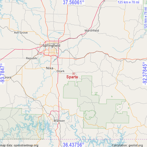
| Upper-left | 37.56061°, | -93.7847° |
| Center: | 37.00116°, | -93.08157° |
| Lower-right: | 36.43756°, | -92.37845° |
| Map W x H: | 124.9×124.9 km | = 77.6×77.6mi |
| max Lat: | 71.29058° ⇑66.1% North |
| Sparta: | 37.00116° |
| min Lat: | ⇓33.9% South 19.06759° |
| min Long | Sparta | max Long |
| -171.73463° | -93.08157° | -66.98998° |
| W 33.6%⇐ | ⇒66.4% E |
Elevation
Elevation of Sparta is 432 m = 1417 ft, and this is 137.2 m = 450 ft above average elevation for this country.
| Max E: |
3189 m = 10463 ft | 14.6% |
| Sparta | 432 m 1417 ft | |
| Avg. | 294.8 m = 967 ft | |
Min E: |
-60 m = -197 ft | 85.4% |
See also: United States elevation on elevation.city.
Geographical zone
Sparta is located in North temperate zone (between Tropic of Cancer and the Arctic Circle). Distance of this Northern Tropic circle is 1508.2 km =937.2 mi to South.| Distance of | km | miles | from Sparta |
|---|---|---|---|
| North Pole | 5892.9 | 3661.7 | to North |
| Arctic Circle | 3287 | 2042.4 | to North |
| Tropic Cancer | 1508.2 | 937.2 | to South |
| Equator | 4114.1 | 2556.4 | to South |


Nearby cities:
15 places around Sparta: (largest is in red/bold)
• Battlefield
28.6 km =17.8 mi,  296°
296°
• Bull Creek
33.6 km =20.9 mi,  198°
198°
• Clever
34.9 km =21.7 mi,  275°
275°
• Fordland
21.4 km =13.3 mi,  35°
35°
• Forsyth
35.3 km =21.9 mi,  185°
185°
• Fremont Hills
16.5 km =10.3 mi, 295°
• Highlandville
19.2 km =11.9 mi,  246°
246°
• Merriam Woods
32.7 km =20.3 mi, 192°
• Nixa
19.5 km =12.1 mi, 283°
• Ozark
11.3 km =7 mi, 281°
• Rockaway Beach
34.3 km =21.3 mi, 191°
• Rogersville
13.1 km =8.1 mi,  10°
10°
• Seymour
32.1 km =19.9 mi,  59°
59°
• Springfield
30.6 km =19 mi,  321°
321°
• Strafford
29.9 km =18.6 mi,  353°
353°
Sources, notices
• [Note1] Compared only with cities in United States existing in our database
• [Src1] Map data: © OpenStreetMap contributors (CC-BY-SA)
• [Src2] Other city data from geonames.org with taken over terms of usage.
• [Src3] Geographical zone / Annual Mean Temperature by Robert A. Rohde @ Wikipedia
