Lebanon geodata
Lebanon (Missouri) is a seat of a second-order administrative division; located in United States in America/Chicago (GMT-5) time zone. With population of 14,688 people, there are 3300 cities with bigger population in this country. Compared to other cities in United States, 63.3% of cities are located further ↑North; 65.6% of cities are located further →East and 82.7% of cities have lower elevation than Lebanon. Note1


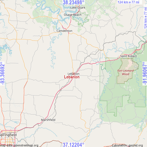
Lebanon GPS coordinates[2]
37° 40' 50.16" North, 92° 39' 49.644" West
| Map corner | latitude | longitude |
|---|---|---|
| Upper-left | 38.23498°, | -93.36692° |
| Center: | 37.6806°, | -92.66379° |
| Lower-right: | 37.12204°, | -91.96067° |
| Map W x H: | 123.7×123.7 km | = 76.9×76.9mi |
| max Lat: | 71.29058° ⇑63.3% North |
| Lebanon: | 37.6806° |
| min Lat: | ⇓36.7% South 19.06759° |
| min Long | Lebanon | max Long |
| -171.73463° | -92.66379° | -66.98998° |
| W 34.4%⇐ | ⇒65.6% E |
Elevation
Elevation of Lebanon is 386 m = 1266 ft, and this is 91.2 m = 299 ft above average elevation for this country.
| Max E: |
3189 m = 10463 ft | 17.3% |
| Lebanon | 386 m 1266 ft | |
| Avg. | 294.8 m = 967 ft | |
Min E: |
-60 m = -197 ft | 82.7% |
See also: United States elevation on elevation.city.
Geographical zone
Lebanon is located in North temperate zone (between Tropic of Cancer and the Arctic Circle). Distance of this Northern Tropic circle is 1583.8 km =984.1 mi to South.| Distance of | km | miles | from Lebanon |
|---|---|---|---|
| North Pole | 5817.4 | 3614.8 | to North |
| Arctic Circle | 3211.5 | 1995.5 | to North |
| Tropic Cancer | 1583.8 | 984.1 | to South |
| Equator | 4189.7 | 2603.4 | to South |


Nearby cities:
15 places around Lebanon: (largest is in red/bold)
• Buffalo
37.9 km =23.5 mi,  263°
263°
• Camdenton
37.1 km =23.1 mi,  348°
348°
• Conway
24.2 km =15 mi,  214°
214°
• Crocker
46.1 km =28.6 mi,  49°
49°
• Fair Grove
54.2 km =33.7 mi,  232°
232°
• Fort Leonard Wood
44.7 km =27.8 mi,  86°
86°
• Four Seasons
57.7 km =35.9 mi,  355°
355°
• Hartville
49.7 km =30.9 mi,  164°
164°
• Iberia
56 km =34.8 mi,  35°
35°
• Lake Ozark
57.6 km =35.8 mi,  2°
2°
• Marshfield
43.7 km =27.2 mi, 209°
• Osage Beach
49.9 km =31 mi, 1°
• Richland
30.1 km =18.7 mi, 49°
• Saint Robert
45.8 km =28.5 mi,  69°
69°
• Waynesville
43.9 km =27.3 mi, 67°
Sources, notices
• [Note1] Compared only with cities in United States existing in our database
• [Src1] Map data: © OpenStreetMap contributors (CC-BY-SA)
• [Src2] Other city data from geonames.org with taken over terms of usage.
• [Src3] Geographical zone / Annual Mean Temperature by Robert A. Rohde @ Wikipedia
