Fort Leonard Wood geodata
Fort Leonard Wood (Missouri) is a populated place; located in United States in America/Chicago (GMT-5) time zone. With population of 15,061 people, there are 3237 cities with bigger population in this country. Compared to other cities in United States, 63.2% of cities are located further ↑North; 64.4% of cities are located further →East and 78.4% of cities have lower elevation than Fort Leonard Wood. Note1
Administrative division(s):
- Level 1: Missouri
- Level 2: Pulaski County
- Level 3: Township of Roubidoux


Fort Leonard Wood GPS coordinates[2]
37° 42' 20.628" North, 92° 9' 25.812" West
| Map corner | latitude | longitude |
|---|---|---|
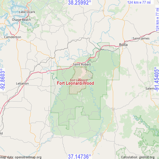
| Upper-left | 38.25992°, | -92.8603° |
| Center: | 37.70573°, | -92.15717° |
| Lower-right: | 37.14736°, | -91.45405° |
| Map W x H: | 123.7×123.7 km | = 76.9×76.9mi |
| max Lat: | 71.29058° ⇑63.2% North |
| Fort Leonard Wood: | 37.70573° |
| min Lat: | ⇓36.8% South 19.06759° |
| min Long | Fort Leonard Wo | max Long |
| -171.73463° | -92.15717° | -66.98998° |
| W 35.6%⇐ | ⇒64.4% E |
Elevation
Elevation of Fort Leonard Wood is 339 m = 1112 ft, and this is 44.2 m = 145 ft above average elevation for this country.
| Max E: |
3189 m = 10463 ft | 21.6% |
| Fort Leonard Wood | 339 m 1112 ft | |
| Avg. | 294.8 m = 967 ft | |
Min E: |
-60 m = -197 ft | 78.4% |
See also: United States elevation on elevation.city.
Geographical zone
Fort Leonard Wood is located in North temperate zone (between Tropic of Cancer and the Arctic Circle). Distance of this Northern Tropic circle is 1586.6 km =985.9 mi to South.| Distance of | km | miles | from Fort Leonard Wood |
|---|---|---|---|
| North Pole | 5814.6 | 3613 | to North |
| Arctic Circle | 3208.7 | 1993.8 | to North |
| Tropic Cancer | 1586.6 | 985.9 | to South |
| Equator | 4192.5 | 2605.1 | to South |


Nearby cities:
15 places around Fort Leonard Wood: (largest is in red/bold)
• Crocker
28.6 km =17.8 mi,  340°
340°
• Dixon
32.3 km =20.1 mi,  9°
9°
• Doolittle
35.6 km =22.1 mi,  42°
42°
• Hartville
59.4 km =36.9 mi,  211°
211°
• Houston
45.8 km =28.5 mi,  157°
157°
• Iberia
44.4 km =27.6 mi, 344°
• Lebanon
44.7 km =27.8 mi,  266°
266°
• Licking
35 km =21.7 mi,  130°
130°
• Richland
27.5 km =17.1 mi,  307°
307°
• Rolla
43.5 km =27 mi,  51°
51°
• Saint James
57.6 km =35.8 mi,  55°
55°
• Saint Robert
13.7 km =8.5 mi,  352°
352°
• Salem
55.1 km =34.2 mi,  96°
96°
• Vienna
56.6 km =35.2 mi,  19°
19°
• Waynesville
14.2 km =8.8 mi, 344°
Sources, notices
• [Note1] Compared only with cities in United States existing in our database
• [Src1] Map data: © OpenStreetMap contributors (CC-BY-SA)
• [Src2] Other city data from geonames.org with taken over terms of usage.
• [Src3] Geographical zone / Annual Mean Temperature by Robert A. Rohde @ Wikipedia
