Saint Robert geodata
Saint Robert (Missouri) is a populated place; located in United States in America/Chicago (GMT-5) time zone. With population of 4,340 people, there are 7824 cities with bigger population in this country. Compared to other cities in United States, 62.5% of cities are located further ↑North; 64.5% of cities are located further →East and 75.5% of cities have lower elevation than Saint Robert. Note1


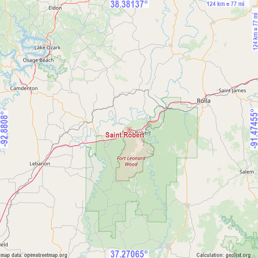
Saint Robert GPS coordinates[2]
37° 49' 41.16" North, 92° 10' 39.612" West
| Map corner | latitude | longitude |
|---|---|---|
| Upper-left | 38.38137°, | -92.8808° |
| Center: | 37.8281°, | -92.17767° |
| Lower-right: | 37.27065°, | -91.47455° |
| Map W x H: | 123.5×123.5 km | = 76.7×76.7mi |
| max Lat: | 71.29058° ⇑62.5% North |
| Saint Robert: | 37.8281° |
| min Lat: | ⇓37.5% South 19.06759° |
| min Long | Saint Robert | max Long |
| -171.73463° | -92.17767° | -66.98998° |
| W 35.5%⇐ | ⇒64.5% E |
Elevation
Elevation of Saint Robert is 317 m = 1040 ft, and this is 22.2 m = 73 ft above average elevation for this country.
| Max E: |
3189 m = 10463 ft | 24.5% |
| Saint Robert | 317 m 1040 ft | |
| Avg. | 294.8 m = 967 ft | |
Min E: |
-60 m = -197 ft | 75.5% |
See also: United States elevation on elevation.city.
Geographical zone
Saint Robert is located in North temperate zone (between Tropic of Cancer and the Arctic Circle). Distance of this Northern Tropic circle is 1600.2 km =994.3 mi to South.| Distance of | km | miles | from Saint Robert |
|---|---|---|---|
| North Pole | 5801 | 3604.6 | to North |
| Arctic Circle | 3195.1 | 1985.3 | to North |
| Tropic Cancer | 1600.2 | 994.3 | to South |
| Equator | 4206.1 | 2613.5 | to South |


Nearby cities:
15 places around Saint Robert: (largest is in red/bold)
• Camdenton
53.6 km =33.3 mi,  291°
291°
• Crocker
15.4 km =9.6 mi,  330°
330°
• Dixon
19.6 km =12.2 mi,  22°
22°
• Doolittle
28.9 km =18 mi,  64°
64°
• Fort Leonard Wood
13.7 km =8.5 mi,  172°
172°
• Iberia
30.8 km =19.1 mi,  340°
340°
• Lebanon
45.8 km =28.5 mi,  249°
249°
• Licking
46.2 km =28.7 mi,  142°
142°
• Osage Beach
53.5 km =33.2 mi,  308°
308°
• Richland
20.2 km =12.6 mi,  279°
279°
• Rolla
38.2 km =23.7 mi,  68°
68°
• Saint James
52.9 km =32.9 mi, 69°
• Tuscumbia
51.3 km =31.9 mi, 331°
• Vienna
44.7 km =27.8 mi,  26°
26°
• Waynesville
2 km =1.2 mi,  271°
271°
Sources, notices
• [Note1] Compared only with cities in United States existing in our database
• [Src1] Map data: © OpenStreetMap contributors (CC-BY-SA)
• [Src2] Other city data from geonames.org with taken over terms of usage.
• [Src3] Geographical zone / Annual Mean Temperature by Robert A. Rohde @ Wikipedia
