Elliott geodata
Elliott (Mississippi) is a populated place; located in United States in America/Chicago (GMT-5) time zone. With population of 990 people, there are 16344 cities with bigger population in this country. Compared to other cities in United States, 82.2% of cities are located further ↑North; 58.3% of cities are located further →East and 75.3% of cities have higher elevation than Elliott. Note1


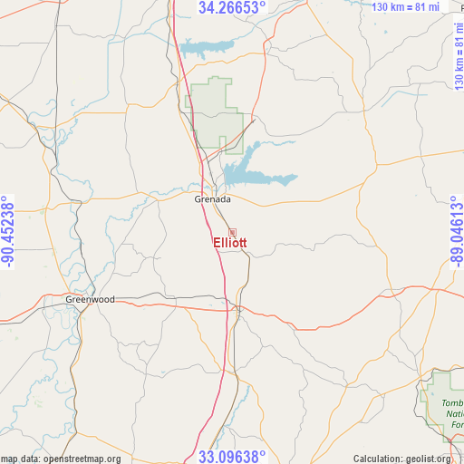
Elliott GPS coordinates[2]
33° 41' 0.42" North, 89° 44' 57.3" West
| Map corner | latitude | longitude |
|---|---|---|
| Upper-left | 34.26653°, | -90.45238° |
| Center: | 33.68345°, | -89.74925° |
| Lower-right: | 33.09638°, | -89.04613° |
| Map W x H: | 130.1×130.1 km | = 80.8×80.8mi |
| max Lat: | 71.29058° ⇑82.2% North |
| Elliott: | 33.68345° |
| min Lat: | ⇓17.8% South 19.06759° |
| min Long | Elliott | max Long |
| -171.73463° | -89.74925° | -66.98998° |
| W 41.7%⇐ | ⇒58.3% E |
Elevation
Elevation of Elliott is 70 m = 230 ft, and this is 224.8 m = 738 ft below average elevation for this country.
| Max E: |
3189 m = 10463 ft | 75.3% |
| Avg. | 294.8 m = 967 ft | |
| Elliott | 70 m = 230 ft | |
Min E: |
-60 m = -197 ft | 24.7% |
See also: United States elevation on elevation.city.
Geographical zone
Elliott is located in North temperate zone (between Tropic of Cancer and the Arctic Circle). Distance of this Northern Tropic circle is 1139.3 km =707.9 mi to South.| Distance of | km | miles | from Elliott |
|---|---|---|---|
| North Pole | 6261.8 | 3890.9 | to North |
| Arctic Circle | 3655.9 | 2271.7 | to North |
| Tropic Cancer | 1139.3 | 707.9 | to South |
| Equator | 3745.2 | 2327.2 | to South |


Nearby cities:
15 places around Elliott: (largest is in red/bold)
• Calhoun City
44.8 km =27.8 mi,  64°
64°
• Carrollton
25.1 km =15.6 mi,  219°
219°
• Charleston
45.8 km =28.5 mi,  321°
321°
• Coffeeville
33.3 km =20.7 mi,  11°
11°
• Derma
47 km =29.2 mi,  65°
65°
• Duck Hill
6.6 km =4.1 mi,  147°
147°
• Eupora
47.4 km =29.5 mi,  109°
109°
• Greenwood
44 km =27.3 mi,  244°
244°
• Grenada
11 km =6.8 mi,  330°
330°
• Holcomb
22.7 km =14.1 mi,  292°
292°
• Kilmichael
31.3 km =19.4 mi, 148°
• Oakland
44.2 km =27.5 mi,  339°
339°
• Vaiden
39.1 km =24.3 mi,  178°
178°
• Walthall
44.5 km =27.7 mi,  100°
100°
• Winona
22.5 km =14 mi, 175°
Sources, notices
• [Note1] Compared only with cities in United States existing in our database
• [Src1] Map data: © OpenStreetMap contributors (CC-BY-SA)
• [Src2] Other city data from geonames.org with taken over terms of usage.
• [Src3] Geographical zone / Annual Mean Temperature by Robert A. Rohde @ Wikipedia
