Rawls Springs geodata
Rawls Springs (Mississippi) is a populated place; located in United States in America/Chicago (GMT-5) time zone. With population of 1,254 people, there are 14828 cities with bigger population in this country. Compared to other cities in United States, 89.9% of cities are located further ↑North; 57.2% of cities are located further →East and 77.5% of cities have higher elevation than Rawls Springs. Note1


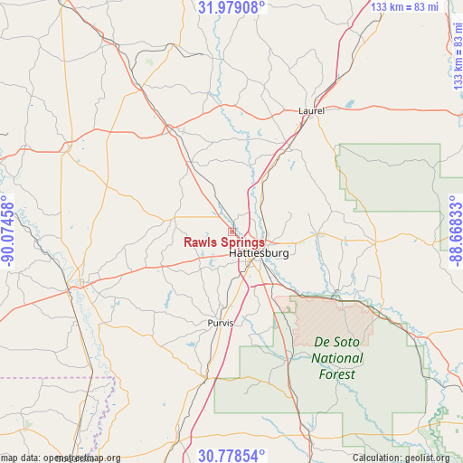
Rawls Springs GPS coordinates[2]
31° 22' 50.628" North, 89° 22' 17.22" West
| Map corner | latitude | longitude |
|---|---|---|
| Upper-left | 31.97908°, | -90.07458° |
| Center: | 31.38073°, | -89.37145° |
| Lower-right: | 30.77854°, | -88.66833° |
| Map W x H: | 133.5×133.5 km | = 83×83mi |
| max Lat: | 71.29058° ⇑89.9% North |
| Rawls Springs: | 31.38073° |
| min Lat: | ⇓10.1% South 19.06759° |
| min Long | Rawls Springs | max Long |
| -171.73463° | -89.37145° | -66.98998° |
| W 42.8%⇐ | ⇒57.2% E |
Elevation
Elevation of Rawls Springs is 58 m = 190 ft, and this is 236.8 m = 777 ft below average elevation for this country.
| Max E: |
3189 m = 10463 ft | 77.5% |
| Avg. | 294.8 m = 967 ft | |
| Rawls Springs | 58 m = 190 ft | |
Min E: |
-60 m = -197 ft | 22.5% |
See also: United States elevation on elevation.city.
Geographical zone
Rawls Springs is located in North temperate zone (between Tropic of Cancer and the Arctic Circle). Distance of this Northern Tropic circle is 883.3 km =548.9 mi to South.| Distance of | km | miles | from Rawls Springs |
|---|---|---|---|
| North Pole | 6517.9 | 4050 | to North |
| Arctic Circle | 3912 | 2430.8 | to North |
| Tropic Cancer | 883.3 | 548.9 | to South |
| Equator | 3489.2 | 2168.1 | to South |


Nearby cities:
15 places around Rawls Springs: (largest is in red/bold)
• Arnold Line
5.1 km =3.2 mi,  182°
182°
• Beaumont
48.9 km =30.4 mi,  118°
118°
• Collins
34.2 km =21.3 mi,  329°
329°
• Columbia
46.5 km =28.9 mi,  252°
252°
• Ellisville
29.9 km =18.6 mi,  33°
33°
• Glendale
6.5 km =4 mi,  106°
106°
• Hattiesburg
9.7 km =6 mi,  127°
127°
• Laurel
41.6 km =25.8 mi, 33°
• Lumberton
42.9 km =26.7 mi,  190°
190°
• New Augusta
37.5 km =23.3 mi, 121°
• Petal
11.2 km =7 mi, 109°
• Purvis
26.7 km =16.6 mi, 187°
• Richton
41.1 km =25.5 mi,  94°
94°
• Sumrall
16.7 km =10.4 mi,  284°
284°
• West Hattiesburg
6.9 km =4.3 mi, 182°
Sources, notices
• [Note1] Compared only with cities in United States existing in our database
• [Src1] Map data: © OpenStreetMap contributors (CC-BY-SA)
• [Src2] Other city data from geonames.org with taken over terms of usage.
• [Src3] Geographical zone / Annual Mean Temperature by Robert A. Rohde @ Wikipedia
