Greenville geodata
Greenville (North Carolina) is a seat of a second-order administrative division; located in United States in America/New_York (GMT-4) time zone. With population of 90,597 people, there are 407 cities with bigger population in this country. Compared to other cities in United States, 72.1% of cities are located further ↑North; 79.4% of cities are located further ←West and 88.6% of cities have higher elevation than Greenville. Note1
Administrative division(s):
- Level 1: North Carolina
- Level 2: Pitt County
- Level 3: Township of Greenville


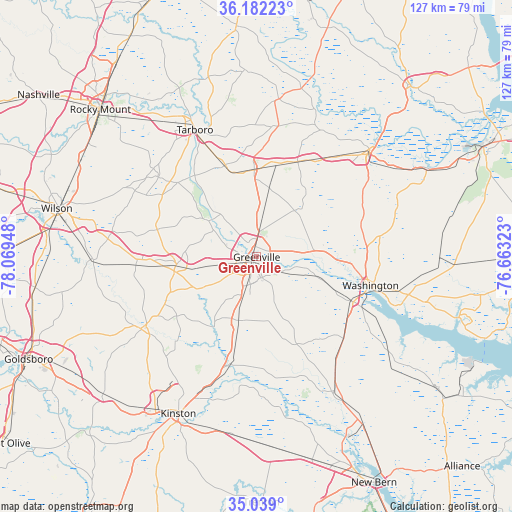
Greenville GPS coordinates[2]
35° 36' 45.576" North, 77° 21' 58.86" West
| Map corner | latitude | longitude |
|---|---|---|
| Upper-left | 36.18223°, | -78.06948° |
| Center: | 35.61266°, | -77.36635° |
| Lower-right: | 35.039°, | -76.66323° |
| Map W x H: | 127.1×127.1 km | = 79×79mi |
| max Lat: | 71.29058° ⇑72.1% North |
| Greenville: | 35.61266° |
| min Lat: | ⇓27.9% South 19.06759° |
| min Long | Greenville | max Long |
| -171.73463° | -77.36635° | -66.98998° |
| W 79.4%⇐ | ⇒20.6% E |
Elevation
Elevation of Greenville is 19 m = 62 ft, and this is 275.8 m = 905 ft below average elevation for this country.
| Max E: |
3189 m = 10463 ft | 88.6% |
| Avg. | 294.8 m = 967 ft | |
| Greenville | 19 m = 62 ft | |
Min E: |
-60 m = -197 ft | 11.4% |
See also: Greenville elevation on elevation.city.
Geographical zone
Greenville is located in North temperate zone (between Tropic of Cancer and the Arctic Circle). Distance of this Northern Tropic circle is 1353.8 km =841.2 mi to South.| Distance of | km | miles | from Greenville |
|---|---|---|---|
| North Pole | 6047.3 | 3757.6 | to North |
| Arctic Circle | 3441.4 | 2138.4 | to North |
| Tropic Cancer | 1353.8 | 841.2 | to South |
| Equator | 3959.8 | 2460.5 | to South |


Nearby cities:
15 places around Greenville: (largest is in red/bold)
• Ayden
16.2 km =10.1 mi,  195°
195°
• Bethel
21.6 km =13.4 mi,  357°
357°
• Chocowinity
26.5 km =16.5 mi,  114°
114°
• Farmville
19.9 km =12.4 mi,  264°
264°
• Grifton
27.5 km =17.1 mi,  193°
193°
• Maury
24.6 km =15.3 mi,  233°
233°
• Pinetops
31.3 km =19.4 mi,  308°
308°
• Princeville
34.2 km =21.3 mi,  334°
334°
• River Road
36 km =22.4 mi, 109°
• Robersonville
25.9 km =16.1 mi,  24°
24°
• Snow Hill
33.6 km =20.9 mi,  237°
237°
• Tarboro
35.1 km =21.8 mi, 334°
• Washington
29.3 km =18.2 mi,  104°
104°
• Windsor
6.7 km =4.2 mi,  175°
175°
• Winterville
9.8 km =6.1 mi, 198°
Sources, notices
• [Note1] Compared only with cities in United States existing in our database
• [Src1] Map data: © OpenStreetMap contributors (CC-BY-SA)
• [Src2] Other city data from geonames.org with taken over terms of usage.
• [Src3] Geographical zone / Annual Mean Temperature by Robert A. Rohde @ Wikipedia
