River Road geodata
River Road (North Carolina) is a populated place; located in United States in America/New_York (GMT-4) time zone. With population of 4,394 people, there are 7759 cities with bigger population in this country. Compared to other cities in United States, 72.6% of cities are located further ↑North; 80.6% of cities are located further ←West and 94.8% of cities have higher elevation than River Road. Note1
Administrative division(s):
- Level 1: North Carolina
- Level 2: Beaufort County
- Level 3: Township of Long Acre


River Road GPS coordinates[2]
35° 30' 24.588" North, 76° 59' 26.808" West
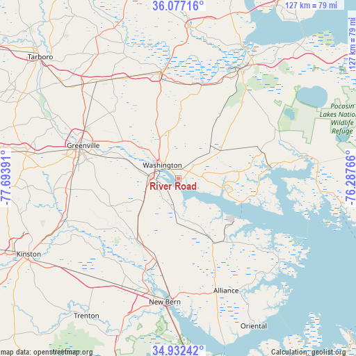
| Map corner | latitude | longitude |
|---|---|---|
| Upper-left | 36.07716°, | -77.69391° |
| Center: | 35.50683°, | -76.99078° |
| Lower-right: | 34.93242°, | -76.28766° |
| Map W x H: | 127.3×127.3 km | = 79.1×79.1mi |
| max Lat: | 71.29058° ⇑72.6% North |
| River Road: | 35.50683° |
| min Lat: | ⇓27.4% South 19.06759° |
| min Long | River Road | max Long |
| -171.73463° | -76.99078° | -66.98998° |
| W 80.6%⇐ | ⇒19.4% E |
Elevation
Elevation of River Road is 9 m = 30 ft, and this is 285.8 m = 938 ft below average elevation for this country.
| Max E: |
3189 m = 10463 ft | 94.8% |
| Avg. | 294.8 m = 967 ft | |
| River Road | 9 m = 30 ft | |
Min E: |
-60 m = -197 ft | 5.2% |
See also: United States elevation on elevation.city.
Geographical zone
River Road is located in North temperate zone (between Tropic of Cancer and the Arctic Circle). Distance of this Northern Tropic circle is 1342.1 km =833.9 mi to South.| Distance of | km | miles | from River Road |
|---|---|---|---|
| North Pole | 6059.1 | 3764.9 | to North |
| Arctic Circle | 3453.2 | 2145.7 | to North |
| Tropic Cancer | 1342.1 | 833.9 | to South |
| Equator | 3948 | 2453.2 | to South |


Nearby cities:
15 places around River Road: (largest is in red/bold)
• Alliance
43.7 km =27.2 mi,  156°
156°
• Aurora
28.9 km =18 mi,  140°
140°
• Ayden
38.6 km =24 mi,  264°
264°
• Belhaven
33.5 km =20.8 mi,  83°
83°
• Chocowinity
10 km =6.2 mi,  273°
273°
• Grantsboro
42.9 km =26.7 mi, 161°
• Greenville
36 km =22.4 mi,  289°
289°
• Grifton
43.1 km =26.8 mi,  249°
249°
• New Bern
44.6 km =27.7 mi,  186°
186°
• Robersonville
42.4 km =26.3 mi,  326°
326°
• Vanceboro
26.6 km =16.5 mi,  213°
213°
• Washington
7.1 km =4.4 mi,  308°
308°
• Williamston
39.1 km =24.3 mi,  351°
351°
• Windsor
33.9 km =21.1 mi,  278°
278°
• Winterville
37.2 km =23.1 mi, 273°
Sources, notices
• [Note1] Compared only with cities in United States existing in our database
• [Src1] Map data: © OpenStreetMap contributors (CC-BY-SA)
• [Src2] Other city data from geonames.org with taken over terms of usage.
• [Src3] Geographical zone / Annual Mean Temperature by Robert A. Rohde @ Wikipedia
