Mint Hill geodata
Mint Hill (North Carolina) is a populated place; located in United States in America/New_York (GMT-4) time zone. With population of 25,627 people, there are 1955 cities with bigger population in this country. Compared to other cities in United States, 74.4% of cities are located further ↑North; 70.4% of cities are located further ←West and 60.5% of cities have lower elevation than Mint Hill. Note1


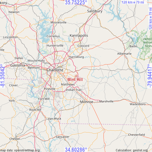
Mint Hill GPS coordinates[2]
35° 10' 46.524" North, 80° 38' 50.244" West
| Map corner | latitude | longitude |
|---|---|---|
| Upper-left | 35.75225°, | -81.35042° |
| Center: | 35.17959°, | -80.64729° |
| Lower-right: | 34.60286°, | -79.94417° |
| Map W x H: | 127.8×127.8 km | = 79.4×79.4mi |
| max Lat: | 71.29058° ⇑74.4% North |
| Mint Hill: | 35.17959° |
| min Lat: | ⇓25.6% South 19.06759° |
| min Long | Mint Hill | max Long |
| -171.73463° | -80.64729° | -66.98998° |
| W 70.4%⇐ | ⇒29.6% E |
Elevation
Elevation of Mint Hill is 242 m = 794 ft, and this is 52.8 m = 173 ft below average elevation for this country.
| Max E: |
3189 m = 10463 ft | 39.5% |
| Avg. | 294.8 m = 967 ft | |
| Mint Hill | 242 m = 794 ft | |
Min E: |
-60 m = -197 ft | 60.5% |
See also: United States elevation on elevation.city.
Geographical zone
Mint Hill is located in North temperate zone (between Tropic of Cancer and the Arctic Circle). Distance of this Northern Tropic circle is 1305.7 km =811.3 mi to South.| Distance of | km | miles | from Mint Hill |
|---|---|---|---|
| North Pole | 6095.5 | 3787.6 | to North |
| Arctic Circle | 3489.6 | 2168.3 | to North |
| Tropic Cancer | 1305.7 | 811.3 | to South |
| Equator | 3911.6 | 2430.6 | to South |


Nearby cities:
15 places around Mint Hill: (largest is in red/bold)
• Charlotte
18.6 km =11.6 mi,  286°
286°
• Fairview
11 km =6.8 mi,  114°
114°
• Harrisburg
16.1 km =10 mi,  356°
356°
• Hemby Bridge
8.6 km =5.3 mi,  168°
168°
• Indian Trail
11.6 km =7.2 mi,  189°
189°
• Lake Park
10.4 km =6.5 mi, 173°
• Locust
22 km =13.7 mi,  66°
66°
• Matthews
9.8 km =6.1 mi,  224°
224°
• Midland
14.3 km =8.9 mi, 68°
• Monroe
23.3 km =14.5 mi,  157°
157°
• Stallings
10.5 km =6.5 mi,  199°
199°
• Stanfield
20.9 km =13 mi, 73°
• Unionville
16.2 km =10.1 mi,  129°
129°
• Weddington
20.3 km =12.6 mi,  210°
210°
• Wesley Chapel
19.3 km =12 mi, 187°
Sources, notices
• [Note1] Compared only with cities in United States existing in our database
• [Src1] Map data: © OpenStreetMap contributors (CC-BY-SA)
• [Src2] Other city data from geonames.org with taken over terms of usage.
• [Src3] Geographical zone / Annual Mean Temperature by Robert A. Rohde @ Wikipedia
