South Gastonia geodata
South Gastonia (North Carolina) is a populated place; located in United States in America/New_York (GMT-4) time zone. With population of 5,312 people, there are 6902 cities with bigger population in this country. Compared to other cities in United States, 74.2% of cities are located further ↑North; 68.9% of cities are located further ←West and 58.6% of cities have lower elevation than South Gastonia. Note1
Administrative division(s):
- Level 1: North Carolina
- Level 2: Gaston County
- Level 3: Township of Gastonia


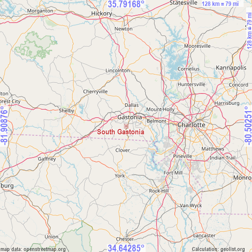
South Gastonia GPS coordinates[2]
35° 13' 9.48" North, 81° 12' 20.268" West
| Map corner | latitude | longitude |
|---|---|---|
| Upper-left | 35.79168°, | -81.90876° |
| Center: | 35.2193°, | -81.20563° |
| Lower-right: | 34.64285°, | -80.50251° |
| Map W x H: | 127.7×127.7 km | = 79.3×79.3mi |
| max Lat: | 71.29058° ⇑74.2% North |
| South Gastonia: | 35.2193° |
| min Lat: | ⇓25.8% South 19.06759° |
| min Long | South Gastonia | max Long |
| -171.73463° | -81.20563° | -66.98998° |
| W 68.9%⇐ | ⇒31.1% E |
Elevation
Elevation of South Gastonia is 233 m = 764 ft, and this is 61.8 m = 203 ft below average elevation for this country.
| Max E: |
3189 m = 10463 ft | 41.4% |
| Avg. | 294.8 m = 967 ft | |
| South Gastonia | 233 m = 764 ft | |
Min E: |
-60 m = -197 ft | 58.6% |
See also: United States elevation on elevation.city.
Geographical zone
South Gastonia is located in North temperate zone (between Tropic of Cancer and the Arctic Circle). Distance of this Northern Tropic circle is 1310.1 km =814.1 mi to South.| Distance of | km | miles | from South Gastonia |
|---|---|---|---|
| North Pole | 6091 | 3784.8 | to North |
| Arctic Circle | 3485.2 | 2165.6 | to North |
| Tropic Cancer | 1310.1 | 814.1 | to South |
| Equator | 3916 | 2433.3 | to South |


Nearby cities:
15 places around South Gastonia: (largest is in red/bold)
• Belmont
15.5 km =9.6 mi,  80°
80°
• Bessemer City
10.2 km =6.3 mi,  315°
315°
• Clover
12.2 km =7.6 mi,  188°
188°
• Cramerton
12.1 km =7.5 mi, 79°
• Dallas
11.1 km =6.9 mi,  13°
13°
• Gastonia
5 km =3.1 mi,  19°
19°
• Kings Mountain
12.6 km =7.8 mi,  283°
283°
• Lake Wylie
19.3 km =12 mi,  129°
129°
• Lowell
10.8 km =6.7 mi,  59°
59°
• McAdenville
12.6 km =7.8 mi,  69°
69°
• Mount Holly
19.3 km =12 mi, 63°
• Ranlo
10.1 km =6.3 mi,  42°
42°
• Stanley
18.4 km =11.4 mi,  32°
32°
• Tryon
17.1 km =10.6 mi, 321°
• White Plains
17.6 km =10.9 mi, 275°
Sources, notices
• [Note1] Compared only with cities in United States existing in our database
• [Src1] Map data: © OpenStreetMap contributors (CC-BY-SA)
• [Src2] Other city data from geonames.org with taken over terms of usage.
• [Src3] Geographical zone / Annual Mean Temperature by Robert A. Rohde @ Wikipedia
