Warrenton geodata
Warrenton (North Carolina) is a seat of a second-order administrative division; located in United States in America/New_York (GMT-4) time zone. With population of 866 people, there are 17228 cities with bigger population in this country. Compared to other cities in United States, 68.5% of cities are located further ↑North; 77.5% of cities are located further ←West and 66.9% of cities have higher elevation than Warrenton. Note1
Administrative division(s):
- Level 1: North Carolina
- Level 2: Warren County
- Level 3: Township of Warrenton


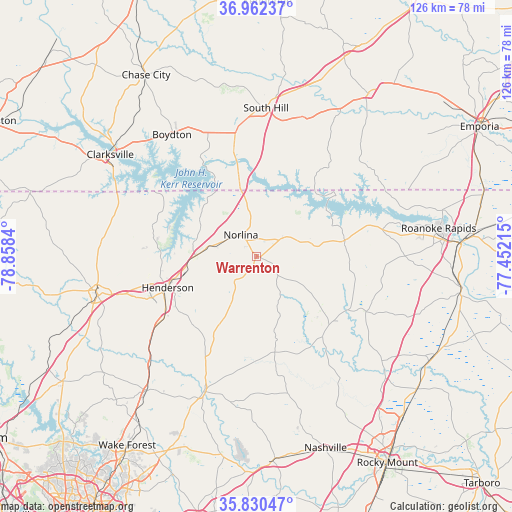
Warrenton GPS coordinates[2]
36° 23' 54.528" North, 78° 9' 18.972" West
| Map corner | latitude | longitude |
|---|---|---|
| Upper-left | 36.96237°, | -78.8584° |
| Center: | 36.39848°, | -78.15527° |
| Lower-right: | 35.83047°, | -77.45215° |
| Map W x H: | 125.9×125.9 km | = 78.2×78.2mi |
| max Lat: | 71.29058° ⇑68.5% North |
| Warrenton: | 36.39848° |
| min Lat: | ⇓31.5% South 19.06759° |
| min Long | Warrenton | max Long |
| -171.73463° | -78.15527° | -66.98998° |
| W 77.5%⇐ | ⇒22.5% E |
Elevation
Elevation of Warrenton is 118 m = 387 ft, and this is 176.8 m = 580 ft below average elevation for this country.
| Max E: |
3189 m = 10463 ft | 66.9% |
| Avg. | 294.8 m = 967 ft | |
| Warrenton | 118 m = 387 ft | |
Min E: |
-60 m = -197 ft | 33.1% |
See also: United States elevation on elevation.city.
Geographical zone
Warrenton is located in North temperate zone (between Tropic of Cancer and the Arctic Circle). Distance of this Northern Tropic circle is 1441.2 km =895.5 mi to South.| Distance of | km | miles | from Warrenton |
|---|---|---|---|
| North Pole | 5959.9 | 3703.3 | to North |
| Arctic Circle | 3354 | 2084.1 | to North |
| Tropic Cancer | 1441.2 | 895.5 | to South |
| Equator | 4047.1 | 2514.8 | to South |


Nearby cities:
15 places around Warrenton: (largest is in red/bold)
• Boydton
36.4 km =22.6 mi,  325°
325°
• Bracey
22.4 km =13.9 mi,  2°
2°
• Clarksville
43.8 km =27.2 mi,  304°
304°
• Franklinton
42.7 km =26.5 mi,  219°
219°
• Henderson
23.1 km =14.4 mi,  250°
250°
• Hollister
25.2 km =15.7 mi,  128°
128°
• La Crosse
33.9 km =21.1 mi,  8°
8°
• Littleton
22.1 km =13.7 mi,  79°
79°
• Louisburg
35.8 km =22.2 mi,  201°
201°
• Norlina
6.5 km =4 mi,  323°
323°
• Oxford
40.2 km =25 mi,  255°
255°
• Roanoke Rapids
45.4 km =28.2 mi, 81°
• South Henderson
24.6 km =15.3 mi, 245°
• South Hill
36.6 km =22.7 mi, 3°
• South Rosemary
41.4 km =25.7 mi, 81°
Sources, notices
• [Note1] Compared only with cities in United States existing in our database
• [Src1] Map data: © OpenStreetMap contributors (CC-BY-SA)
• [Src2] Other city data from geonames.org with taken over terms of usage.
• [Src3] Geographical zone / Annual Mean Temperature by Robert A. Rohde @ Wikipedia
