Carnegie geodata
Carnegie (Oklahoma) is a populated place; located in United States in America/Chicago (GMT-5) time zone. With population of 1,700 people, there are 12910 cities with bigger population in this country. Compared to other cities in United States, 74.8% of cities are located further ↑North; 79.5% of cities are located further →East and 84.2% of cities have lower elevation than Carnegie. Note1


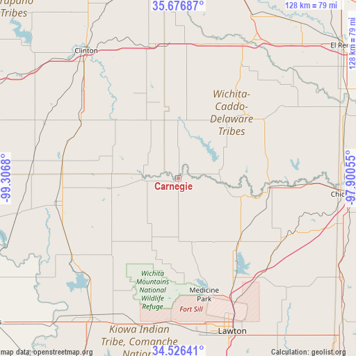
Carnegie GPS coordinates[2]
35° 6' 13.212" North, 98° 36' 13.212" West
| Map corner | latitude | longitude |
|---|---|---|
| Upper-left | 35.67687°, | -99.3068° |
| Center: | 35.10367°, | -98.60367° |
| Lower-right: | 34.52641°, | -97.90055° |
| Map W x H: | 127.9×127.9 km | = 79.5×79.5mi |
| max Lat: | 71.29058° ⇑74.8% North |
| Carnegie: | 35.10367° |
| min Lat: | ⇓25.2% South 19.06759° |
| min Long | Carnegie | max Long |
| -171.73463° | -98.60367° | -66.98998° |
| W 20.5%⇐ | ⇒79.5% E |
Elevation
Elevation of Carnegie is 408 m = 1339 ft, and this is 113.2 m = 371 ft above average elevation for this country.
| Max E: |
3189 m = 10463 ft | 15.8% |
| Carnegie | 408 m 1339 ft | |
| Avg. | 294.8 m = 967 ft | |
Min E: |
-60 m = -197 ft | 84.2% |
See also: United States elevation on elevation.city.
Geographical zone
Carnegie is located in North temperate zone (between Tropic of Cancer and the Arctic Circle). Distance of this Northern Tropic circle is 1297.2 km =806 mi to South.| Distance of | km | miles | from Carnegie |
|---|---|---|---|
| North Pole | 6103.9 | 3792.8 | to North |
| Arctic Circle | 3498 | 2173.6 | to North |
| Tropic Cancer | 1297.2 | 806 | to South |
| Equator | 3903.2 | 2425.3 | to South |


Nearby cities:
15 places around Carnegie: (largest is in red/bold)
• Anadarko
32.9 km =20.4 mi,  96°
96°
• Apache
31.8 km =19.8 mi,  137°
137°
• Binger
33 km =20.5 mi,  46°
46°
• Cordell
40.7 km =25.3 mi,  300°
300°
• Corn
34.5 km =21.4 mi,  332°
332°
• Cyril
43.3 km =26.9 mi,  122°
122°
• Elgin
45.8 km =28.5 mi, 141°
• Fletcher
45.2 km =28.1 mi,  133°
133°
• Fort Cobb
15.3 km =9.5 mi,  92°
92°
• Hinton
46.7 km =29 mi,  28°
28°
• Hobart
45.3 km =28.1 mi,  259°
259°
• Hydro
49.6 km =30.8 mi,  2°
2°
• Mountain View
13 km =8.1 mi,  267°
267°
• Verden
47 km =29.2 mi, 92°
• Weatherford
47.9 km =29.8 mi,  348°
348°
Sources, notices
• [Note1] Compared only with cities in United States existing in our database
• [Src1] Map data: © OpenStreetMap contributors (CC-BY-SA)
• [Src2] Other city data from geonames.org with taken over terms of usage.
• [Src3] Geographical zone / Annual Mean Temperature by Robert A. Rohde @ Wikipedia
