Harrah geodata
Harrah (Oklahoma) is a populated place; located in United States in America/Chicago (GMT-5) time zone. With population of 5,891 people, there are 6482 cities with bigger population in this country. Compared to other cities in United States, 72.7% of cities are located further ↑North; 76.2% of cities are located further →East and 78.5% of cities have lower elevation than Harrah. Note1


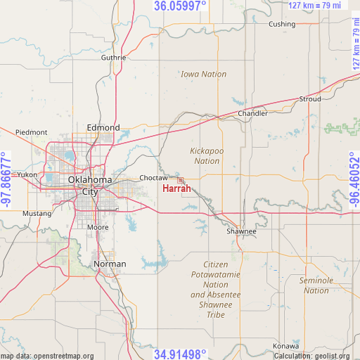
Harrah GPS coordinates[2]
35° 29' 22.236" North, 97° 9' 49.104" West
| Map corner | latitude | longitude |
|---|---|---|
| Upper-left | 36.05997°, | -97.86677° |
| Center: | 35.48951°, | -97.16364° |
| Lower-right: | 34.91498°, | -96.46052° |
| Map W x H: | 127.3×127.3 km | = 79.1×79.1mi |
| max Lat: | 71.29058° ⇑72.7% North |
| Harrah: | 35.48951° |
| min Lat: | ⇓27.3% South 19.06759° |
| min Long | Harrah | max Long |
| -171.73463° | -97.16364° | -66.98998° |
| W 23.8%⇐ | ⇒76.2% E |
Elevation
Elevation of Harrah is 340 m = 1115 ft, and this is 45.2 m = 148 ft above average elevation for this country.
| Max E: |
3189 m = 10463 ft | 21.5% |
| Harrah | 340 m 1115 ft | |
| Avg. | 294.8 m = 967 ft | |
Min E: |
-60 m = -197 ft | 78.5% |
See also: United States elevation on elevation.city.
Geographical zone
Harrah is located in North temperate zone (between Tropic of Cancer and the Arctic Circle). Distance of this Northern Tropic circle is 1340.1 km =832.7 mi to South.| Distance of | km | miles | from Harrah |
|---|---|---|---|
| North Pole | 6061 | 3766.1 | to North |
| Arctic Circle | 3455.1 | 2146.9 | to North |
| Tropic Cancer | 1340.1 | 832.7 | to South |
| Equator | 3946.1 | 2452 | to South |


Nearby cities:
15 places around Harrah: (largest is in red/bold)
• Bethel Acres
23.7 km =14.7 mi,  148°
148°
• Choctaw
9.6 km =6 mi,  275°
275°
• Del City
25.7 km =16 mi,  258°
258°
• Forest Park
25.6 km =15.9 mi,  273°
273°
• Jones
14 km =8.7 mi,  307°
307°
• Luther
19.4 km =12.1 mi,  351°
351°
• McLoud
8.8 km =5.5 mi,  132°
132°
• Meeker
23.7 km =14.7 mi,  86°
86°
• Midwest City
21.6 km =13.4 mi, 258°
• Nicoma Park
14.4 km =8.9 mi, 270°
• Pink
25.8 km =16 mi,  171°
171°
• Shawnee
28.1 km =17.5 mi, 129°
• Spencer
19.7 km =12.2 mi, 280°
• Valley Brook
30.4 km =18.9 mi,  251°
251°
• Wellston
24.5 km =15.2 mi,  21°
21°
Sources, notices
• [Note1] Compared only with cities in United States existing in our database
• [Src1] Map data: © OpenStreetMap contributors (CC-BY-SA)
• [Src2] Other city data from geonames.org with taken over terms of usage.
• [Src3] Geographical zone / Annual Mean Temperature by Robert A. Rohde @ Wikipedia
