Stillwater geodata
Stillwater (Oklahoma) is a seat of a second-order administrative division; located in United States in America/Chicago (GMT-5) time zone. With population of 48,967 people, there are 978 cities with bigger population in this country. Compared to other cities in United States, 69.8% of cities are located further ↑North; 75.9% of cities are located further →East and 68.2% of cities have lower elevation than Stillwater. Note1


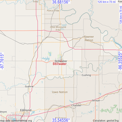
Stillwater GPS coordinates[2]
36° 6' 56.196" North, 97° 3' 30.132" West
| Map corner | latitude | longitude |
|---|---|---|
| Upper-left | 36.68156°, | -97.7615° |
| Center: | 36.11561°, | -97.05837° |
| Lower-right: | 35.54556°, | -96.35525° |
| Map W x H: | 126.3×126.3 km | = 78.5×78.5mi |
| max Lat: | 71.29058° ⇑69.8% North |
| Stillwater: | 36.11561° |
| min Lat: | ⇓30.2% South 19.06759° |
| min Long | Stillwater | max Long |
| -171.73463° | -97.05837° | -66.98998° |
| W 24.1%⇐ | ⇒75.9% E |
Elevation
Elevation of Stillwater is 277 m = 909 ft, and this is 17.8 m = 58 ft below average elevation for this country.
| Max E: |
3189 m = 10463 ft | 31.8% |
| Avg. | 294.8 m = 967 ft | |
| Stillwater | 277 m = 909 ft | |
Min E: |
-60 m = -197 ft | 68.2% |
See also: Stillwater elevation on elevation.city.
Geographical zone
Stillwater is located in North temperate zone (between Tropic of Cancer and the Arctic Circle). Distance of this Northern Tropic circle is 1409.8 km =876 mi to South.| Distance of | km | miles | from Stillwater |
|---|---|---|---|
| North Pole | 5991.4 | 3722.9 | to North |
| Arctic Circle | 3385.5 | 2103.7 | to North |
| Tropic Cancer | 1409.8 | 876 | to South |
| Equator | 4015.7 | 2495.2 | to South |


Nearby cities:
15 places around Stillwater: (largest is in red/bold)
• Carney
34.4 km =21.4 mi,  173°
173°
• Chandler
48.7 km =30.3 mi,  160°
160°
• Cushing
29.9 km =18.6 mi,  118°
118°
• Drumright
43.5 km =27 mi,  108°
108°
• Glencoe
17.3 km =10.7 mi,  43°
43°
• Guthrie
42.2 km =26.2 mi,  231°
231°
• Langston
25.9 km =16.1 mi,  223°
223°
• Morrison
20.7 km =12.9 mi,  12°
12°
• Oilton
42.8 km =26.6 mi,  94°
94°
• Pawnee
33.6 km =20.9 mi, 42°
• Perkins
15.9 km =9.9 mi, 171°
• Perry
28.3 km =17.6 mi,  313°
313°
• Tryon
28.6 km =17.8 mi, 162°
• Wellston
46.9 km =29.1 mi,  180°
180°
• Yale
32.3 km =20.1 mi, 90°
Sources, notices
• [Note1] Compared only with cities in United States existing in our database
• [Src1] Map data: © OpenStreetMap contributors (CC-BY-SA)
• [Src2] Other city data from geonames.org with taken over terms of usage.
• [Src3] Geographical zone / Annual Mean Temperature by Robert A. Rohde @ Wikipedia
