Gloverville geodata
Gloverville (South Carolina) is a populated place; located in United States in America/New_York (GMT-4) time zone. With population of 2,831 people, there are 9945 cities with bigger population in this country. Compared to other cities in United States, 83% of cities are located further ↑North; 66.2% of cities are located further ←West and 76.3% of cities have higher elevation than Gloverville. Note1


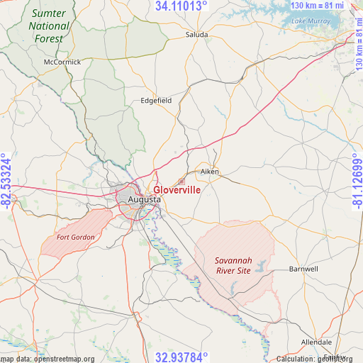
Gloverville GPS coordinates[2]
33° 31' 33.492" North, 81° 49' 48.396" West
| Map corner | latitude | longitude |
|---|---|---|
| Upper-left | 34.11013°, | -82.53324° |
| Center: | 33.52597°, | -81.83011° |
| Lower-right: | 32.93784°, | -81.12699° |
| Map W x H: | 130.3×130.3 km | = 81×81mi |
| max Lat: | 71.29058° ⇑83% North |
| Gloverville: | 33.52597° |
| min Lat: | ⇓17% South 19.06759° |
| min Long | Gloverville | max Long |
| -171.73463° | -81.83011° | -66.98998° |
| W 66.2%⇐ | ⇒33.8% E |
Elevation
Elevation of Gloverville is 64 m = 210 ft, and this is 230.8 m = 757 ft below average elevation for this country.
| Max E: |
3189 m = 10463 ft | 76.3% |
| Avg. | 294.8 m = 967 ft | |
| Gloverville | 64 m = 210 ft | |
Min E: |
-60 m = -197 ft | 23.7% |
See also: United States elevation on elevation.city.
Geographical zone
Gloverville is located in North temperate zone (between Tropic of Cancer and the Arctic Circle). Distance of this Northern Tropic circle is 1121.8 km =697.1 mi to South.| Distance of | km | miles | from Gloverville |
|---|---|---|---|
| North Pole | 6279.3 | 3901.8 | to North |
| Arctic Circle | 3673.4 | 2282.5 | to North |
| Tropic Cancer | 1121.8 | 697.1 | to South |
| Equator | 3727.7 | 2316.3 | to South |


Nearby cities:
15 places around Gloverville: (largest is in red/bold)
• Aiken
10.9 km =6.8 mi,  69°
69°
• Augusta
14.7 km =9.1 mi,  245°
245°
• Belvedere
10.6 km =6.6 mi,  272°
272°
• Burnettown
2.1 km =1.3 mi,  236°
236°
• Clearwater
6.6 km =4.1 mi, 240°
• Evans
27.9 km =17.3 mi, 271°
• Graniteville
4.7 km =2.9 mi,  26°
26°
• Jackson
22.6 km =14 mi,  170°
170°
• Kingston
23.6 km =14.7 mi,  257°
257°
• Langley
1.6 km =1 mi, 235°
• Martinez
22.8 km =14.2 mi, 267°
• Murphys Estates
13.5 km =8.4 mi,  308°
308°
• New Ellenton
17.7 km =11 mi,  130°
130°
• North Augusta
12.8 km =8 mi, 257°
• Warrenville
3.7 km =2.3 mi,  41°
41°
Sources, notices
• [Note1] Compared only with cities in United States existing in our database
• [Src1] Map data: © OpenStreetMap contributors (CC-BY-SA)
• [Src2] Other city data from geonames.org with taken over terms of usage.
• [Src3] Geographical zone / Annual Mean Temperature by Robert A. Rohde @ Wikipedia
