New Ellenton geodata
New Ellenton (South Carolina) is a populated place; located in United States in America/New_York (GMT-4) time zone. With population of 2,121 people, there are 11551 cities with bigger population in this country. Compared to other cities in United States, 83.5% of cities are located further ↑North; 66.7% of cities are located further ←West and 65.2% of cities have higher elevation than New Ellenton. Note1


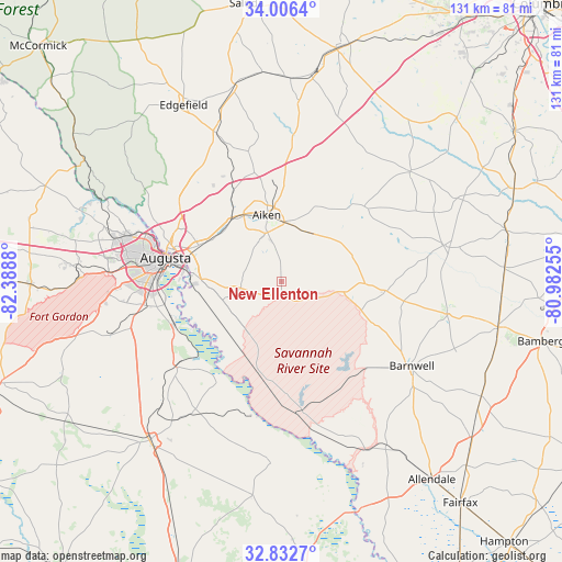
New Ellenton GPS coordinates[2]
33° 25' 17.508" North, 81° 41' 8.412" West
| Map corner | latitude | longitude |
|---|---|---|
| Upper-left | 34.0064°, | -82.3888° |
| Center: | 33.42153°, | -81.68567° |
| Lower-right: | 32.8327°, | -80.98255° |
| Map W x H: | 130.5×130.5 km | = 81.1×81.1mi |
| max Lat: | 71.29058° ⇑83.5% North |
| New Ellenton: | 33.42153° |
| min Lat: | ⇓16.5% South 19.06759° |
| min Long | New Ellenton | max Long |
| -171.73463° | -81.68567° | -66.98998° |
| W 66.7%⇐ | ⇒33.3% E |
Elevation
Elevation of New Ellenton is 127 m = 417 ft, and this is 167.8 m = 551 ft below average elevation for this country.
| Max E: |
3189 m = 10463 ft | 65.2% |
| Avg. | 294.8 m = 967 ft | |
| New Ellenton | 127 m = 417 ft | |
Min E: |
-60 m = -197 ft | 34.8% |
See also: United States elevation on elevation.city.
Geographical zone
New Ellenton is located in North temperate zone (between Tropic of Cancer and the Arctic Circle). Distance of this Northern Tropic circle is 1110.2 km =689.8 mi to South.| Distance of | km | miles | from New Ellenton |
|---|---|---|---|
| North Pole | 6290.9 | 3909 | to North |
| Arctic Circle | 3685 | 2289.8 | to North |
| Tropic Cancer | 1110.2 | 689.8 | to South |
| Equator | 3716.1 | 2309.1 | to South |


Nearby cities:
15 places around New Ellenton: (largest is in red/bold)
• Aiken
15.8 km =9.8 mi,  348°
348°
• Augusta
27.4 km =17 mi,  281°
281°
• Barnwell
36.2 km =22.5 mi,  122°
122°
• Belvedere
26.9 km =16.7 mi,  296°
296°
• Burnettown
18.4 km =11.4 mi, 304°
• Clearwater
20.9 km =13 mi,  293°
293°
• Gloverville
17.7 km =11 mi,  310°
310°
• Graniteville
19.5 km =12.1 mi,  324°
324°
• Jackson
14.3 km =8.9 mi,  221°
221°
• Kingston
37.1 km =23.1 mi, 280°
• Langley
18.2 km =11.3 mi, 306°
• Murphys Estates
31.2 km =19.4 mi, 309°
• North Augusta
27.4 km =17 mi, 288°
• Warrenville
18.1 km =11.2 mi, 322°
• Williston
24.7 km =15.3 mi,  94°
94°
Sources, notices
• [Note1] Compared only with cities in United States existing in our database
• [Src1] Map data: © OpenStreetMap contributors (CC-BY-SA)
• [Src2] Other city data from geonames.org with taken over terms of usage.
• [Src3] Geographical zone / Annual Mean Temperature by Robert A. Rohde @ Wikipedia
