Fall Branch geodata
Fall Branch (Tennessee) is a populated place; located in United States in America/New_York (GMT-4) time zone. With population of 1,291 people, there are 14633 cities with bigger population in this country. Compared to other cities in United States, 68.4% of cities are located further ↑North; 63.2% of cities are located further ←West and 86.6% of cities have lower elevation than Fall Branch. Note1


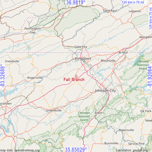
Fall Branch GPS coordinates[2]
36° 25' 5.376" North, 82° 37' 25.536" West
| Map corner | latitude | longitude |
|---|---|---|
| Upper-left | 36.9819°, | -83.32689° |
| Center: | 36.41816°, | -82.62376° |
| Lower-right: | 35.85029°, | -81.92064° |
| Map W x H: | 125.8×125.8 km | = 78.2×78.2mi |
| max Lat: | 71.29058° ⇑68.4% North |
| Fall Branch: | 36.41816° |
| min Lat: | ⇓31.6% South 19.06759° |
| min Long | Fall Branch | max Long |
| -171.73463° | -82.62376° | -66.98998° |
| W 63.2%⇐ | ⇒36.8% E |
Elevation
Elevation of Fall Branch is 457 m = 1499 ft, and this is 162.2 m = 532 ft above average elevation for this country.
| Max E: |
3189 m = 10463 ft | 13.4% |
| Fall Branch | 457 m 1499 ft | |
| Avg. | 294.8 m = 967 ft | |
Min E: |
-60 m = -197 ft | 86.6% |
See also: United States elevation on elevation.city.
Geographical zone
Fall Branch is located in North temperate zone (between Tropic of Cancer and the Arctic Circle). Distance of this Northern Tropic circle is 1443.4 km =896.9 mi to South.| Distance of | km | miles | from Fall Branch |
|---|---|---|---|
| North Pole | 5957.7 | 3701.9 | to North |
| Arctic Circle | 3351.9 | 2082.8 | to North |
| Tropic Cancer | 1443.4 | 896.9 | to South |
| Equator | 4049.3 | 2516.1 | to South |


Nearby cities:
15 places around Fall Branch: (largest is in red/bold)
• Bloomingdale
22.1 km =13.7 mi,  33°
33°
• Church Hill
14.1 km =8.8 mi,  325°
325°
• Colonial Heights
13.1 km =8.1 mi,  55°
55°
• Gate City
24.7 km =15.3 mi,  8°
8°
• Gray
13.2 km =8.2 mi,  89°
89°
• Johnson City
26.9 km =16.7 mi,  115°
115°
• Jonesborough
19.3 km =12 mi,  135°
135°
• Kingsport
15.5 km =9.6 mi,  20°
20°
• Midway
22.2 km =13.8 mi,  126°
126°
• Mount Carmel
14.5 km =9 mi,  346°
346°
• Oak Grove
17.8 km =11.1 mi, 92°
• Spurgeon
15.2 km =9.4 mi,  81°
81°
• Surgoinsville
21.2 km =13.2 mi,  286°
286°
• Telford
20.1 km =12.5 mi,  159°
159°
• Weber City
23.4 km =14.5 mi, 13°
Sources, notices
• [Note1] Compared only with cities in United States existing in our database
• [Src1] Map data: © OpenStreetMap contributors (CC-BY-SA)
• [Src2] Other city data from geonames.org with taken over terms of usage.
• [Src3] Geographical zone / Annual Mean Temperature by Robert A. Rohde @ Wikipedia
