Hendersonville geodata
Hendersonville (Tennessee) is a populated place; located in United States in America/Chicago (GMT-5) time zone. With population of 56,018 people, there are 817 cities with bigger population in this country. Compared to other cities in United States, 68.9% of cities are located further ↑North; 51.2% of cities are located further ←West and 61.3% of cities have higher elevation than Hendersonville. Note1


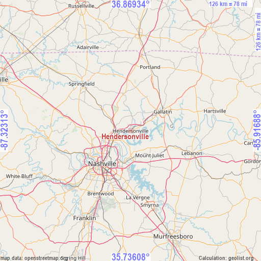
Hendersonville GPS coordinates[2]
36° 18' 17.172" North, 86° 37' 12" West
| Map corner | latitude | longitude |
|---|---|---|
| Upper-left | 36.86934°, | -87.32313° |
| Center: | 36.30477°, | -86.62° |
| Lower-right: | 35.73608°, | -85.91688° |
| Map W x H: | 126×126 km | = 78.3×78.3mi |
| max Lat: | 71.29058° ⇑68.9% North |
| Hendersonville: | 36.30477° |
| min Lat: | ⇓31.1% South 19.06759° |
| min Long | Hendersonville | max Long |
| -171.73463° | -86.62° | -66.98998° |
| W 51.2%⇐ | ⇒48.8% E |
Elevation
Elevation of Hendersonville is 148 m = 486 ft, and this is 146.8 m = 482 ft below average elevation for this country.
| Max E: |
3189 m = 10463 ft | 61.3% |
| Avg. | 294.8 m = 967 ft | |
| Hendersonville | 148 m = 486 ft | |
Min E: |
-60 m = -197 ft | 38.7% |
See also: Hendersonville elevation on elevation.city.
Geographical zone
Hendersonville is located in North temperate zone (between Tropic of Cancer and the Arctic Circle). Distance of this Northern Tropic circle is 1430.8 km =889.1 mi to South.| Distance of | km | miles | from Hendersonville |
|---|---|---|---|
| North Pole | 5970.3 | 3709.8 | to North |
| Arctic Circle | 3364.5 | 2090.6 | to North |
| Tropic Cancer | 1430.8 | 889.1 | to South |
| Equator | 4036.7 | 2508.3 | to South |


Nearby cities:
15 places around Hendersonville: (largest is in red/bold)
• Berry Hill
24.7 km =15.3 mi,  212°
212°
• Cross Plains
28 km =17.4 mi,  345°
345°
• Gallatin
18.1 km =11.2 mi,  59°
59°
• Goodlettsville
8.6 km =5.3 mi,  283°
283°
• Green Hill
11.1 km =6.9 mi,  145°
145°
• Greenbrier
21.4 km =13.3 mi,  309°
309°
• Lakewood
7 km =4.3 mi,  191°
191°
• Millersville
10.9 km =6.8 mi, 312°
• Mount Juliet
14.8 km =9.2 mi,  142°
142°
• Nashville
21.4 km =13.3 mi,  223°
223°
• Ridgetop
17.5 km =10.9 mi, 305°
• Rural Hill
24.4 km =15.2 mi, 148°
• Shackle Island
7.3 km =4.5 mi,  2°
2°
• Walnut Grove
20 km =12.4 mi, 1°
• White House
18.6 km =11.6 mi, 351°
Sources, notices
• [Note1] Compared only with cities in United States existing in our database
• [Src1] Map data: © OpenStreetMap contributors (CC-BY-SA)
• [Src2] Other city data from geonames.org with taken over terms of usage.
• [Src3] Geographical zone / Annual Mean Temperature by Robert A. Rohde @ Wikipedia
