Hunter geodata
Hunter (Tennessee) is a populated place; located in United States in America/New_York (GMT-4) time zone. With population of 1,697 people, there are 12922 cities with bigger population in this country. Compared to other cities in United States, 68.7% of cities are located further ↑North; 58.9% of cities are located further ←West and 77.8% of cities have lower elevation than Hunter. Note1


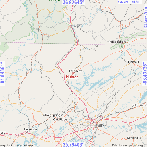
Hunter GPS coordinates[2]
36° 21' 44.28" North, 84° 8' 25.728" West
| Map corner | latitude | longitude |
|---|---|---|
| Upper-left | 36.92645°, | -84.84361° |
| Center: | 36.3623°, | -84.14048° |
| Lower-right: | 35.79403°, | -83.43736° |
| Map W x H: | 125.9×125.9 km | = 78.2×78.2mi |
| max Lat: | 71.29058° ⇑68.7% North |
| Hunter: | 36.3623° |
| min Lat: | ⇓31.3% South 19.06759° |
| min Long | Hunter | max Long |
| -171.73463° | -84.14048° | -66.98998° |
| W 58.9%⇐ | ⇒41.1% E |
Elevation
Elevation of Hunter is 334 m = 1096 ft, and this is 39.2 m = 129 ft above average elevation for this country.
| Max E: |
3189 m = 10463 ft | 22.2% |
| Hunter | 334 m 1096 ft | |
| Avg. | 294.8 m = 967 ft | |
Min E: |
-60 m = -197 ft | 77.8% |
See also: United States elevation on elevation.city.
Geographical zone
Hunter is located in North temperate zone (between Tropic of Cancer and the Arctic Circle). Distance of this Northern Tropic circle is 1437.2 km =893 mi to South.| Distance of | km | miles | from Hunter |
|---|---|---|---|
| North Pole | 5964 | 3705.9 | to North |
| Arctic Circle | 3358.1 | 2086.6 | to North |
| Tropic Cancer | 1437.2 | 893 | to South |
| Equator | 4043.1 | 2512.3 | to South |


Nearby cities:
15 places around Hunter: (largest is in red/bold)
• Caryville
10.2 km =6.3 mi,  226°
226°
• Clinton
28.8 km =17.9 mi,  178°
178°
• Condon
37 km =23 mi,  122°
122°
• Fincastle
9.8 km =6.1 mi,  57°
57°
• Helenwood
36.9 km =22.9 mi,  281°
281°
• Huntsville
31.8 km =19.8 mi, 279°
• Jacksboro
5.3 km =3.3 mi, 227°
• Jellico
25.1 km =15.6 mi,  2°
2°
• LaFollette
2.9 km =1.8 mi,  38°
38°
• Maynardville
33.2 km =20.6 mi,  111°
111°
• Norris
19.6 km =12.2 mi,  160°
160°
• Oneida
36.6 km =22.7 mi,  294°
294°
• Pine Crest
9.6 km =6 mi,  173°
173°
• Rocky Top
16.1 km =10 mi, 184°
• Winfield
35.2 km =21.9 mi,  307°
307°
Sources, notices
• [Note1] Compared only with cities in United States existing in our database
• [Src1] Map data: © OpenStreetMap contributors (CC-BY-SA)
• [Src2] Other city data from geonames.org with taken over terms of usage.
• [Src3] Geographical zone / Annual Mean Temperature by Robert A. Rohde @ Wikipedia
