Lampasas geodata
Lampasas (Texas) is a seat of a second-order administrative division; located in United States in America/Chicago (GMT-5) time zone. With population of 7,687 people, there are 5430 cities with bigger population in this country. Compared to other cities in United States, 90.6% of cities are located further ↑North; 78.9% of cities are located further →East and 75.3% of cities have lower elevation than Lampasas. Note1


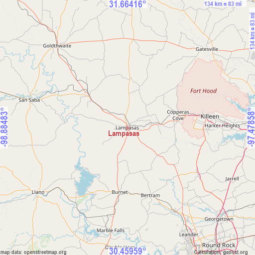
Lampasas GPS coordinates[2]
31° 3' 49.608" North, 98° 10' 54.12" West
| Map corner | latitude | longitude |
|---|---|---|
| Upper-left | 31.66416°, | -98.88483° |
| Center: | 31.06378°, | -98.1817° |
| Lower-right: | 30.45959°, | -97.47858° |
| Map W x H: | 133.9×133.9 km | = 83.2×83.2mi |
| max Lat: | 71.29058° ⇑90.6% North |
| Lampasas: | 31.06378° |
| min Lat: | ⇓9.4% South 19.06759° |
| min Long | Lampasas | max Long |
| -171.73463° | -98.1817° | -66.98998° |
| W 21.1%⇐ | ⇒78.9% E |
Elevation
Elevation of Lampasas is 315 m = 1033 ft, and this is 20.2 m = 66 ft above average elevation for this country.
| Max E: |
3189 m = 10463 ft | 24.7% |
| Lampasas | 315 m 1033 ft | |
| Avg. | 294.8 m = 967 ft | |
Min E: |
-60 m = -197 ft | 75.3% |
See also: United States elevation on elevation.city.
Geographical zone
Lampasas is located in North temperate zone (between Tropic of Cancer and the Arctic Circle). Distance of this Northern Tropic circle is 848 km =526.9 mi to South.| Distance of | km | miles | from Lampasas |
|---|---|---|---|
| North Pole | 6553.1 | 4071.9 | to North |
| Arctic Circle | 3947.2 | 2452.7 | to North |
| Tropic Cancer | 848 | 526.9 | to South |
| Equator | 3454 | 2146.2 | to South |


Nearby cities:
15 places around Lampasas: (largest is in red/bold)
• Bertram
37.6 km =23.4 mi,  161°
161°
• Buchanan Dam
43.2 km =26.8 mi,  213°
213°
• Buchanan Lake Village
34.8 km =21.6 mi,  227°
227°
• Burnet
34.3 km =21.3 mi,  187°
187°
• Copperas Cove
27.4 km =17 mi,  75°
75°
• Florence
44.5 km =27.7 mi,  123°
123°
• Fort Hood
39.5 km =24.5 mi, 78°
• Harker Heights
49.8 km =30.9 mi,  87°
87°
• Kempner
17.2 km =10.7 mi, 83°
• Killeen
43.6 km =27.1 mi, 82°
• Kingsland
51.4 km =31.9 mi, 208°
• Liberty Hill
50.8 km =31.6 mi,  150°
150°
• Lometa
26.4 km =16.4 mi,  310°
310°
• Marble Falls
54.7 km =34 mi, 189°
• San Saba
53.1 km =33 mi,  286°
286°
Sources, notices
• [Note1] Compared only with cities in United States existing in our database
• [Src1] Map data: © OpenStreetMap contributors (CC-BY-SA)
• [Src2] Other city data from geonames.org with taken over terms of usage.
• [Src3] Geographical zone / Annual Mean Temperature by Robert A. Rohde @ Wikipedia
