Olney geodata
Olney (Texas) is a populated place; located in United States in America/Chicago (GMT-5) time zone. With population of 3,179 people, there are 9337 cities with bigger population in this country. Compared to other cities in United States, 83.7% of cities are located further ↑North; 79.7% of cities are located further →East and 81.2% of cities have lower elevation than Olney. Note1


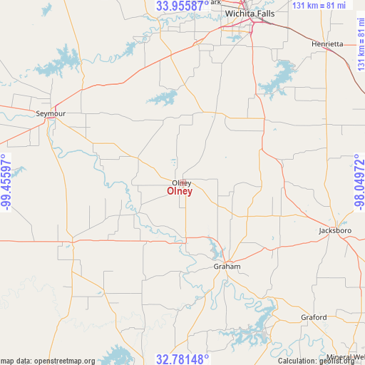
Olney GPS coordinates[2]
33° 22' 14.376" North, 98° 45' 10.224" West
| Map corner | latitude | longitude |
|---|---|---|
| Upper-left | 33.95587°, | -99.45597° |
| Center: | 33.37066°, | -98.75284° |
| Lower-right: | 32.78148°, | -98.04972° |
| Map W x H: | 130.6×130.6 km | = 81.2×81.2mi |
| max Lat: | 71.29058° ⇑83.7% North |
| Olney: | 33.37066° |
| min Lat: | ⇓16.3% South 19.06759° |
| min Long | Olney | max Long |
| -171.73463° | -98.75284° | -66.98998° |
| W 20.3%⇐ | ⇒79.7% E |
Elevation
Elevation of Olney is 367 m = 1204 ft, and this is 72.2 m = 237 ft above average elevation for this country.
| Max E: |
3189 m = 10463 ft | 18.8% |
| Olney | 367 m 1204 ft | |
| Avg. | 294.8 m = 967 ft | |
Min E: |
-60 m = -197 ft | 81.2% |
See also: United States elevation on elevation.city.
Geographical zone
Olney is located in North temperate zone (between Tropic of Cancer and the Arctic Circle). Distance of this Northern Tropic circle is 1104.6 km =686.4 mi to South.| Distance of | km | miles | from Olney |
|---|---|---|---|
| North Pole | 6296.6 | 3912.5 | to North |
| Arctic Circle | 3690.7 | 2293.3 | to North |
| Tropic Cancer | 1104.6 | 686.4 | to South |
| Equator | 3710.5 | 2305.6 | to South |


Nearby cities:
15 places around Olney: (largest is in red/bold)
• Archer City
27.7 km =17.2 mi,  25°
25°
• Breckenridge
69.8 km =43.4 mi,  191°
191°
• Bryson
41.3 km =25.7 mi,  124°
124°
• Electra
74.8 km =46.5 mi,  348°
348°
• Graford
67.3 km =41.8 mi,  135°
135°
• Graham
33 km =20.5 mi,  152°
152°
• Henrietta
71.6 km =44.5 mi,  46°
46°
• Holliday
49.8 km =30.9 mi,  6°
6°
• Iowa Park
65 km =40.4 mi, 6°
• Jacksboro
57.8 km =35.9 mi,  107°
107°
• Lakeside City
54.4 km =33.8 mi,  20°
20°
• Newcastle
19.7 km =12.2 mi,  176°
176°
• Seymour
53.2 km =33.1 mi,  297°
297°
• Throckmorton
44.9 km =27.9 mi,  241°
241°
• Wichita Falls
65 km =40.4 mi, 21°
Sources, notices
• [Note1] Compared only with cities in United States existing in our database
• [Src1] Map data: © OpenStreetMap contributors (CC-BY-SA)
• [Src2] Other city data from geonames.org with taken over terms of usage.
• [Src3] Geographical zone / Annual Mean Temperature by Robert A. Rohde @ Wikipedia
