Chapmanville geodata
Chapmanville (West Virginia) is a populated place; located in United States in America/New_York (GMT-4) time zone. With population of 1,205 people, there are 15100 cities with bigger population in this country. Compared to other cities in United States, 61.8% of cities are located further ↑North; 65.5% of cities are located further ←West and 50.3% of cities have higher elevation than Chapmanville. Note1


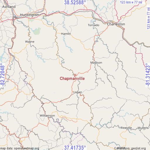
Chapmanville GPS coordinates[2]
37° 58' 25.356" North, 82° 1' 2.46" West
| Map corner | latitude | longitude |
|---|---|---|
| Upper-left | 38.52588°, | -82.72048° |
| Center: | 37.97371°, | -82.01735° |
| Lower-right: | 37.41735°, | -81.31423° |
| Map W x H: | 123.3×123.3 km | = 76.6×76.6mi |
| max Lat: | 71.29058° ⇑61.8% North |
| Chapmanville: | 37.97371° |
| min Lat: | ⇓38.2% South 19.06759° |
| min Long | Chapmanville | max Long |
| -171.73463° | -82.01735° | -66.98998° |
| W 65.5%⇐ | ⇒34.5% E |
Elevation
Elevation of Chapmanville is 197 m = 646 ft, and this is 97.8 m = 321 ft below average elevation for this country.
| Max E: |
3189 m = 10463 ft | 50.3% |
| Avg. | 294.8 m = 967 ft | |
| Chapmanville | 197 m = 646 ft | |
Min E: |
-60 m = -197 ft | 49.7% |
See also: United States elevation on elevation.city.
Geographical zone
Chapmanville is located in North temperate zone (between Tropic of Cancer and the Arctic Circle). Distance of this Northern Tropic circle is 1616.4 km =1004.4 mi to South.| Distance of | km | miles | from Chapmanville |
|---|---|---|---|
| North Pole | 5784.8 | 3594.5 | to North |
| Arctic Circle | 3178.9 | 1975.3 | to North |
| Tropic Cancer | 1616.4 | 1004.4 | to South |
| Equator | 4222.3 | 2623.6 | to South |


Nearby cities:
15 places around Chapmanville: (largest is in red/bold)
• Accoville
27.7 km =17.2 mi,  145°
145°
• Danville
20 km =12.4 mi,  53°
53°
• Harts
11.7 km =7.3 mi,  303°
303°
• Holden
17 km =10.6 mi,  192°
192°
• Kistler
27.8 km =17.3 mi, 150°
• Logan
14.1 km =8.8 mi,  171°
171°
• Madison
20.2 km =12.6 mi,  59°
59°
• Mallory
31.3 km =19.4 mi, 149°
• Man
28.8 km =17.9 mi, 154°
• McConnell
17 km =10.6 mi,  164°
164°
• Mount Gay-Shamrock
15.1 km =9.4 mi,  184°
184°
• Omar
24.3 km =15.1 mi, 176°
• Robinette
28.7 km =17.8 mi,  136°
136°
• Switzer
20.2 km =12.6 mi, 172°
• Verdunville
14.7 km =9.1 mi, 192°
Sources, notices
• [Note1] Compared only with cities in United States existing in our database
• [Src1] Map data: © OpenStreetMap contributors (CC-BY-SA)
• [Src2] Other city data from geonames.org with taken over terms of usage.
• [Src3] Geographical zone / Annual Mean Temperature by Robert A. Rohde @ Wikipedia
