Jewett City geodata
Jewett City (Connecticut) is a populated place; located in United States in America/New_York (GMT-4) time zone. With population of 3,441 people, there are 8926 cities with bigger population in this country. Compared to other cities in United States, 71.9% of cities are located further ↓South; 95.8% of cities are located further ←West and 80.1% of cities have higher elevation than Jewett City. Note1
Administrative division(s):
- Level 1: Connecticut
- Level 2: New London County
- Level 3: Town of Griswold


Jewett City GPS coordinates[2]
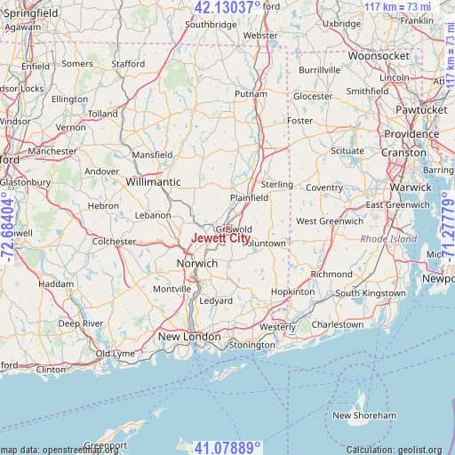
41° 36' 24.372" North, 71° 58' 51.276" West
| Map corner | latitude | longitude |
|---|---|---|
| Upper-left | 42.13037°, | -72.68404° |
| Center: | 41.60677°, | -71.98091° |
| Lower-right: | 41.07889°, | -71.27779° |
| Map W x H: | 116.9×116.9 km | = 72.6×72.6mi |
| max Lat: | 71.29058° ⇑28.1% North |
| Jewett City: | 41.60677° |
| min Lat: | ⇓71.9% South 19.06759° |
| min Long | Jewett City | max Long |
| -171.73463° | -71.98091° | -66.98998° |
| W 95.8%⇐ | ⇒4.2% E |
Elevation
Elevation of Jewett City is 46 m = 151 ft, and this is 248.8 m = 816 ft below average elevation for this country.
| Max E: |
3189 m = 10463 ft | 80.1% |
| Avg. | 294.8 m = 967 ft | |
| Jewett City | 46 m = 151 ft | |
Min E: |
-60 m = -197 ft | 19.9% |
See also: United States elevation on elevation.city.
Geographical zone
Jewett City is located in North temperate zone (between Tropic of Cancer and the Arctic Circle). Distance of this Northern Tropic circle is 2020.3 km =1255.4 mi to South.| Distance of | km | miles | from Jewett City |
|---|---|---|---|
| North Pole | 5380.8 | 3343.5 | to North |
| Arctic Circle | 2774.9 | 1724.2 | to North |
| Tropic Cancer | 2020.3 | 1255.4 | to South |
| Equator | 4626.2 | 2874.6 | to South |


Nearby cities:
15 places around Jewett City: (largest is in red/bold)
• Baltic
8.7 km =5.4 mi,  277°
277°
• Brooklyn
20.3 km =12.6 mi,  7°
7°
• Gales Ferry
21.4 km =13.3 mi,  203°
203°
• Greene
21.7 km =13.5 mi,  64°
64°
• Ledyard
18.8 km =11.7 mi,  188°
188°
• Lisbon
2.6 km =1.6 mi,  263°
263°
• Montville Center
20.1 km =12.5 mi,  224°
224°
• Moosup
14.4 km =8.9 mi,  35°
35°
• Norwich
12.1 km =7.5 mi, 220°
• Plainfield
9.5 km =5.9 mi, 35°
• Plainfield Village
9.1 km =5.7 mi,  30°
30°
• Preston City
8.7 km =5.4 mi,  176°
176°
• South Windham
17.7 km =11 mi,  297°
297°
• Wauregan
16.4 km =10.2 mi,  21°
21°
• Windham
17.9 km =11.1 mi,  305°
305°
Sources, notices
• [Note1] Compared only with cities in United States existing in our database
• [Src1] Map data: © OpenStreetMap contributors (CC-BY-SA)
• [Src2] Other city data from geonames.org with taken over terms of usage.
• [Src3] Geographical zone / Annual Mean Temperature by Robert A. Rohde @ Wikipedia
