Moosup geodata
Moosup (Connecticut) is a populated place; located in United States in America/New_York (GMT-4) time zone. With population of 3,231 people, there are 9260 cities with bigger population in this country. Compared to other cities in United States, 73.1% of cities are located further ↓South; 95.9% of cities are located further ←West and 74.2% of cities have higher elevation than Moosup. Note1
Administrative division(s):
- Level 1: Connecticut
- Level 2: Windham County
- Level 3: Town of Plainfield


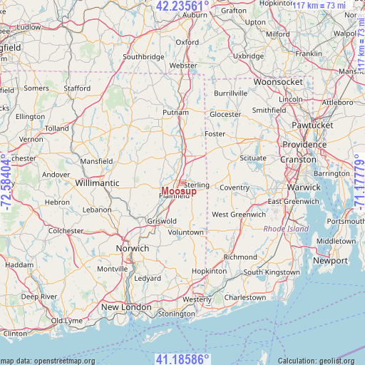
Moosup GPS coordinates[2]
41° 42' 46.368" North, 71° 52' 51.276" West
| Map corner | latitude | longitude |
|---|---|---|
| Upper-left | 42.23561°, | -72.58404° |
| Center: | 41.71288°, | -71.88091° |
| Lower-right: | 41.18586°, | -71.17779° |
| Map W x H: | 116.7×116.7 km | = 72.5×72.5mi |
| max Lat: | 71.29058° ⇑26.9% North |
| Moosup: | 41.71288° |
| min Lat: | ⇓73.1% South 19.06759° |
| min Long | Moosup | max Long |
| -171.73463° | -71.88091° | -66.98998° |
| W 95.9%⇐ | ⇒4.1% E |
Elevation
Elevation of Moosup is 76 m = 249 ft, and this is 218.8 m = 718 ft below average elevation for this country.
| Max E: |
3189 m = 10463 ft | 74.2% |
| Avg. | 294.8 m = 967 ft | |
| Moosup | 76 m = 249 ft | |
Min E: |
-60 m = -197 ft | 25.8% |
See also: United States elevation on elevation.city.
Geographical zone
Moosup is located in North temperate zone (between Tropic of Cancer and the Arctic Circle). Distance of this Northern Tropic circle is 2032.1 km =1262.7 mi to South.| Distance of | km | miles | from Moosup |
|---|---|---|---|
| North Pole | 5369 | 3336.1 | to North |
| Arctic Circle | 2763.1 | 1716.9 | to North |
| Tropic Cancer | 2032.1 | 1262.7 | to South |
| Equator | 4638 | 2881.9 | to South |


Nearby cities:
15 places around Moosup: (largest is in red/bold)
• Baltic
20 km =12.4 mi,  237°
237°
• Brooklyn
10.1 km =6.3 mi,  325°
325°
• Coventry
16.5 km =10.3 mi,  94°
94°
• Danielson
10 km =6.2 mi,  357°
357°
• East Brooklyn
9.4 km =5.8 mi,  351°
351°
• Foster
18.7 km =11.6 mi,  33°
33°
• Greene
11.5 km =7.1 mi,  102°
102°
• Jewett City
14.4 km =8.9 mi,  215°
215°
• Killingly Center
14 km =8.7 mi,  3°
3°
• Lisbon
16.3 km =10.1 mi, 221°
• Plainfield
4.9 km =3 mi, 215°
• Plainfield Village
5.4 km =3.4 mi, 222°
• Preston City
21.9 km =13.6 mi,  200°
200°
• Wauregan
4.2 km =2.6 mi, 326°
• West Greenwich
20.2 km =12.6 mi,  114°
114°
Sources, notices
• [Note1] Compared only with cities in United States existing in our database
• [Src1] Map data: © OpenStreetMap contributors (CC-BY-SA)
• [Src2] Other city data from geonames.org with taken over terms of usage.
• [Src3] Geographical zone / Annual Mean Temperature by Robert A. Rohde @ Wikipedia
