Wallingford geodata
Wallingford (Connecticut) is a populated place; located in United States in America/New_York (GMT-4) time zone. With population of 17,712 people, there are 2820 cities with bigger population in this country. Compared to other cities in United States, 70.4% of cities are located further ↓South; 94.2% of cities are located further ←West and 87% of cities have higher elevation than Wallingford. Note1
Administrative division(s):
- Level 1: Connecticut
- Level 2: New Haven County
- Level 3: Town of Wallingford


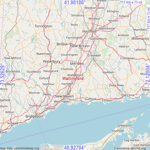
Wallingford GPS coordinates[2]
41° 27' 25.344" North, 72° 49' 23.376" West
| Map corner | latitude | longitude |
|---|---|---|
| Upper-left | 41.98186°, | -73.52629° |
| Center: | 41.45704°, | -72.82316° |
| Lower-right: | 40.92794°, | -72.12004° |
| Map W x H: | 117.2×117.2 km | = 72.8×72.8mi |
| max Lat: | 71.29058° ⇑29.6% North |
| Wallingford: | 41.45704° |
| min Lat: | ⇓70.4% South 19.06759° |
| min Long | Wallingford | max Long |
| -171.73463° | -72.82316° | -66.98998° |
| W 94.2%⇐ | ⇒5.8% E |
Elevation
Elevation of Wallingford is 23 m = 75 ft, and this is 271.8 m = 892 ft below average elevation for this country.
| Max E: |
3189 m = 10463 ft | 87% |
| Avg. | 294.8 m = 967 ft | |
| Wallingford | 23 m = 75 ft | |
Min E: |
-60 m = -197 ft | 13% |
See also: United States elevation on elevation.city.
Geographical zone
Wallingford is located in North temperate zone (between Tropic of Cancer and the Arctic Circle). Distance of this Northern Tropic circle is 2003.7 km =1245 mi to South.| Distance of | km | miles | from Wallingford |
|---|---|---|---|
| North Pole | 5397.5 | 3353.8 | to North |
| Arctic Circle | 2791.6 | 1734.6 | to North |
| Tropic Cancer | 2003.7 | 1245 | to South |
| Equator | 4609.6 | 2864.3 | to South |


Nearby cities:
15 places around Wallingford: (largest is in red/bold)
• Branford
19.7 km =12.2 mi,  178°
178°
• Cheshire
8 km =5 mi,  305°
305°
• Cheshire Village
8.1 km =5 mi, 308°
• Durham
12.1 km =7.5 mi,  76°
76°
• Hamden
9.2 km =5.7 mi,  222°
222°
• Meriden
9.1 km =5.7 mi,  8°
8°
• Middletown
18.5 km =11.5 mi,  50°
50°
• Naugatuck
19.2 km =11.9 mi,  279°
279°
• New Haven
18.7 km =11.6 mi,  207°
207°
• North Branford
15.1 km =9.4 mi,  162°
162°
• North Haven
8 km =5 mi,  202°
202°
• Portland
19.9 km =12.4 mi, 49°
• Prospect
13.9 km =8.6 mi,  291°
291°
• Wallingford Center
0.9 km =0.6 mi, 156°
• Woodbridge
19.3 km =12 mi,  233°
233°
Sources, notices
• [Note1] Compared only with cities in United States existing in our database
• [Src1] Map data: © OpenStreetMap contributors (CC-BY-SA)
• [Src2] Other city data from geonames.org with taken over terms of usage.
• [Src3] Geographical zone / Annual Mean Temperature by Robert A. Rohde @ Wikipedia
