Beaverdale geodata
Beaverdale (Iowa) is a populated place; located in United States in America/Chicago (GMT-5) time zone. With population of 952 people, there are 16623 cities with bigger population in this country. Compared to other cities in United States, 63.9% of cities are located further ↓South; 62.5% of cities are located further →East and 53.9% of cities have lower elevation than Beaverdale. Note1
Administrative division(s):
- Level 1: Iowa
- Level 2: Des Moines County
- Level 3: Township of Flint River


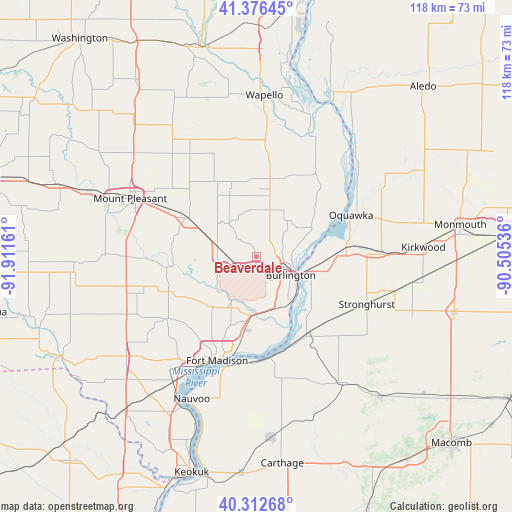
Beaverdale GPS coordinates[2]
40° 50' 48.12" North, 91° 12' 30.528" West
| Map corner | latitude | longitude |
|---|---|---|
| Upper-left | 41.37645°, | -91.91161° |
| Center: | 40.8467°, | -91.20848° |
| Lower-right: | 40.31268°, | -90.50536° |
| Map W x H: | 118.3×118.3 km | = 73.5×73.5mi |
| max Lat: | 71.29058° ⇑36.1% North |
| Beaverdale: | 40.8467° |
| min Lat: | ⇓63.9% South 19.06759° |
| min Long | Beaverdale | max Long |
| -171.73463° | -91.20848° | -66.98998° |
| W 37.5%⇐ | ⇒62.5% E |
Elevation
Elevation of Beaverdale is 214 m = 702 ft, and this is 80.8 m = 265 ft below average elevation for this country.
| Max E: |
3189 m = 10463 ft | 46.1% |
| Avg. | 294.8 m = 967 ft | |
| Beaverdale | 214 m = 702 ft | |
Min E: |
-60 m = -197 ft | 53.9% |
See also: United States elevation on elevation.city.
Geographical zone
Beaverdale is located in North temperate zone (between Tropic of Cancer and the Arctic Circle). Distance of this Northern Tropic circle is 1935.8 km =1202.8 mi to South.| Distance of | km | miles | from Beaverdale |
|---|---|---|---|
| North Pole | 5465.3 | 3396 | to North |
| Arctic Circle | 2859.4 | 1776.7 | to North |
| Tropic Cancer | 1935.8 | 1202.8 | to South |
| Equator | 4541.7 | 2822.1 | to South |


Nearby cities:
15 places around Beaverdale: (largest is in red/bold)
• Burlington
9.1 km =5.7 mi,  118°
118°
• Dallas City
23.7 km =14.7 mi,  171°
171°
• Danville
9.1 km =5.7 mi,  282°
282°
• Fort Madison
25.7 km =16 mi,  200°
200°
• Keithsburg
35.9 km =22.3 mi,  38°
38°
• La Harpe
35.5 km =22.1 mi,  145°
145°
• Mediapolis
18.3 km =11.4 mi,  11°
11°
• Morning Sun
28 km =17.4 mi,  351°
351°
• Mount Pleasant
32.1 km =19.9 mi,  293°
293°
• Nauvoo
36.2 km =22.5 mi, 204°
• New London
18.4 km =11.4 mi,  299°
299°
• Oquawka
23.9 km =14.9 mi,  66°
66°
• Stronghurst
27.9 km =17.3 mi,  113°
113°
• West Burlington
5 km =3.1 mi, 118°
• West Point
25 km =15.5 mi,  234°
234°
Sources, notices
• [Note1] Compared only with cities in United States existing in our database
• [Src1] Map data: © OpenStreetMap contributors (CC-BY-SA)
• [Src2] Other city data from geonames.org with taken over terms of usage.
• [Src3] Geographical zone / Annual Mean Temperature by Robert A. Rohde @ Wikipedia
