Council Bluffs geodata
Council Bluffs (Iowa) is a seat of a second-order administrative division; located in United States in America/Chicago (GMT-5) time zone. With population of 62,597 people, there are 698 cities with bigger population in this country. Compared to other cities in United States, 68.4% of cities are located further ↓South; 73.1% of cities are located further →East and 72.6% of cities have lower elevation than Council Bluffs. Note1


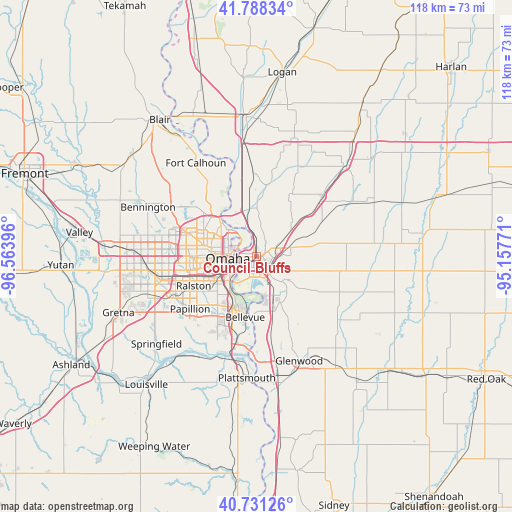
Council Bluffs GPS coordinates[2]
41° 15' 42.984" North, 95° 51' 38.988" West
| Map corner | latitude | longitude |
|---|---|---|
| Upper-left | 41.78834°, | -96.56396° |
| Center: | 41.26194°, | -95.86083° |
| Lower-right: | 40.73126°, | -95.15771° |
| Map W x H: | 117.5×117.5 km | = 73×73mi |
| max Lat: | 71.29058° ⇑31.6% North |
| Council Bluffs: | 41.26194° |
| min Lat: | ⇓68.4% South 19.06759° |
| min Long | Council Bluffs | max Long |
| -171.73463° | -95.86083° | -66.98998° |
| W 26.9%⇐ | ⇒73.1% E |
Elevation
Elevation of Council Bluffs is 299 m = 981 ft, and this is 4.2 m = 14 ft above average elevation for this country.
| Max E: |
3189 m = 10463 ft | 27.4% |
| Council Bluffs | 299 m 981 ft | |
| Avg. | 294.8 m = 967 ft | |
Min E: |
-60 m = -197 ft | 72.6% |
See also: Council Bluffs elevation on elevation.city.
Geographical zone
Council Bluffs is located in North temperate zone (between Tropic of Cancer and the Arctic Circle). Distance of this Northern Tropic circle is 1982 km =1231.6 mi to South.| Distance of | km | miles | from Council Bluffs |
|---|---|---|---|
| North Pole | 5419.2 | 3367.3 | to North |
| Arctic Circle | 2813.3 | 1748.1 | to North |
| Tropic Cancer | 1982 | 1231.6 | to South |
| Equator | 4587.9 | 2850.8 | to South |


Nearby cities:
15 places around Council Bluffs: (largest is in red/bold)
• Bellevue
14.2 km =8.8 mi,  190°
190°
• Bennington
27.3 km =17 mi,  294°
294°
• Boys Town
22.7 km =14.1 mi,  269°
269°
• Carter Lake
5.7 km =3.5 mi,  303°
303°
• Chalco
25.7 km =16 mi,  250°
250°
• Crescent
11.5 km =7.1 mi,  1°
1°
• Fort Calhoun
25.6 km =15.9 mi,  327°
327°
• Glenwood
25.9 km =16.1 mi,  157°
157°
• La Vista
16.7 km =10.4 mi,  238°
238°
• Offutt Air Force Base
16.5 km =10.3 mi,  197°
197°
• Omaha
6.7 km =4.2 mi,  264°
264°
• Papillion
19.3 km =12 mi,  231°
231°
• Ralston
16.4 km =10.2 mi, 247°
• Treynor
21 km =13 mi,  98°
98°
• Underwood
20.7 km =12.9 mi,  47°
47°
Sources, notices
• [Note1] Compared only with cities in United States existing in our database
• [Src1] Map data: © OpenStreetMap contributors (CC-BY-SA)
• [Src2] Other city data from geonames.org with taken over terms of usage.
• [Src3] Geographical zone / Annual Mean Temperature by Robert A. Rohde @ Wikipedia
