Manning geodata
Manning (Iowa) is a populated place; located in United States in America/Chicago (GMT-5) time zone. With population of 1,472 people, there are 13784 cities with bigger population in this country. Compared to other cities in United States, 74.9% of cities are located further ↓South; 71.2% of cities are located further →East and 84.2% of cities have lower elevation than Manning. Note1


Manning GPS coordinates[2]
41° 54' 32.94" North, 95° 3' 53.964" West
| Map corner | latitude | longitude |
|---|---|---|
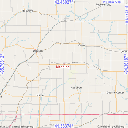
| Upper-left | 42.43027°, | -95.76812° |
| Center: | 41.90915°, | -95.06499° |
| Lower-right: | 41.38374°, | -94.36187° |
| Map W x H: | 116.4×116.4 km | = 72.3×72.3mi |
| max Lat: | 71.29058° ⇑25.1% North |
| Manning: | 41.90915° |
| min Lat: | ⇓74.9% South 19.06759° |
| min Long | Manning | max Long |
| -171.73463° | -95.06499° | -66.98998° |
| W 28.8%⇐ | ⇒71.2% E |
Elevation
Elevation of Manning is 409 m = 1342 ft, and this is 114.2 m = 375 ft above average elevation for this country.
| Max E: |
3189 m = 10463 ft | 15.8% |
| Manning | 409 m 1342 ft | |
| Avg. | 294.8 m = 967 ft | |
Min E: |
-60 m = -197 ft | 84.2% |
See also: United States elevation on elevation.city.
Geographical zone
Manning is located in North temperate zone (between Tropic of Cancer and the Arctic Circle). Distance of this Northern Tropic circle is 2053.9 km =1276.2 mi to South.| Distance of | km | miles | from Manning |
|---|---|---|---|
| North Pole | 5347.2 | 3322.6 | to North |
| Arctic Circle | 2741.3 | 1703.4 | to North |
| Tropic Cancer | 2053.9 | 1276.2 | to South |
| Equator | 4659.9 | 2895.5 | to South |


Nearby cities:
15 places around Manning: (largest is in red/bold)
• Audubon
23.9 km =14.9 mi,  152°
152°
• Carroll
23.9 km =14.9 mi,  43°
43°
• Coon Rapids
32.4 km =20.1 mi,  97°
97°
• Denison
26.9 km =16.7 mi,  296°
296°
• Dunlap
44.8 km =27.8 mi,  262°
262°
• Elk Horn
35.3 km =21.9 mi,  179°
179°
• Exira
38.7 km =24 mi,  156°
156°
• Glidden
32.3 km =20.1 mi,  59°
59°
• Harlan
35.7 km =22.2 mi,  217°
217°
• Lake View
44.8 km =27.8 mi,  1°
1°
• Manilla
14 km =8.7 mi, 261°
• Odebolt
47.4 km =29.5 mi,  341°
341°
• Schleswig
41.9 km =26 mi,  312°
312°
• Scranton
44.8 km =27.8 mi,  73°
73°
• Wall Lake
40.3 km =25 mi,  356°
356°
Sources, notices
• [Note1] Compared only with cities in United States existing in our database
• [Src1] Map data: © OpenStreetMap contributors (CC-BY-SA)
• [Src2] Other city data from geonames.org with taken over terms of usage.
• [Src3] Geographical zone / Annual Mean Temperature by Robert A. Rohde @ Wikipedia
