Melcher-Dallas geodata
Melcher-Dallas (Iowa) is a populated place; located in United States in America/Chicago (GMT-5) time zone. With population of 1,259 people, there are 14798 cities with bigger population in this country. Compared to other cities in United States, 68% of cities are located further ↓South; 66.8% of cities are located further →East and 70.1% of cities have lower elevation than Melcher-Dallas. Note1


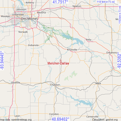
Melcher-Dallas GPS coordinates[2]
41° 13' 30" North, 93° 14' 28.752" West
| Map corner | latitude | longitude |
|---|---|---|
| Upper-left | 41.7517°, | -93.94445° |
| Center: | 41.225°, | -93.24132° |
| Lower-right: | 40.69402°, | -92.5382° |
| Map W x H: | 117.6×117.6 km | = 73.1×73.1mi |
| max Lat: | 71.29058° ⇑32% North |
| Melcher-Dallas: | 41.225° |
| min Lat: | ⇓68% South 19.06759° |
| min Long | Melcher-Dallas | max Long |
| -171.73463° | -93.24132° | -66.98998° |
| W 33.2%⇐ | ⇒66.8% E |
Elevation
Elevation of Melcher-Dallas is 286 m = 938 ft, and this is 8.8 m = 29 ft below average elevation for this country.
| Max E: |
3189 m = 10463 ft | 29.9% |
| Avg. | 294.8 m = 967 ft | |
| Melcher-Dallas | 286 m = 938 ft | |
Min E: |
-60 m = -197 ft | 70.1% |
See also: United States elevation on elevation.city.
Geographical zone
Melcher-Dallas is located in North temperate zone (between Tropic of Cancer and the Arctic Circle). Distance of this Northern Tropic circle is 1977.9 km =1229 mi to South.| Distance of | km | miles | from Melcher-Dallas |
|---|---|---|---|
| North Pole | 5423.3 | 3369.9 | to North |
| Arctic Circle | 2817.4 | 1750.7 | to North |
| Tropic Cancer | 1977.9 | 1229 | to South |
| Equator | 4583.8 | 2848.2 | to South |


Nearby cities:
15 places around Melcher-Dallas: (largest is in red/bold)
• Albia
42.6 km =26.5 mi,  121°
121°
• Carlisle
37.1 km =23.1 mi,  325°
325°
• Chariton
24.1 km =15 mi,  193°
193°
• Hartford
29.4 km =18.3 mi, 332°
• Indianola
30.3 km =18.8 mi,  299°
299°
• Knoxville
15.3 km =9.5 mi,  45°
45°
• Lovilia
29.9 km =18.6 mi,  109°
109°
• Milo
18.4 km =11.4 mi,  293°
293°
• Monroe
35 km =21.7 mi,  19°
19°
• Norwalk
45.9 km =28.5 mi,  307°
307°
• Pella
33.9 km =21.1 mi, 53°
• Pleasantville
18 km =11.2 mi,  352°
352°
• Prairie City
41.6 km =25.8 mi,  0°
0°
• Runnells
33.3 km =20.7 mi,  343°
343°
• Russell
27.3 km =17 mi,  172°
172°
Sources, notices
• [Note1] Compared only with cities in United States existing in our database
• [Src1] Map data: © OpenStreetMap contributors (CC-BY-SA)
• [Src2] Other city data from geonames.org with taken over terms of usage.
• [Src3] Geographical zone / Annual Mean Temperature by Robert A. Rohde @ Wikipedia
