Story City geodata
Story City (Iowa) is a populated place; located in United States in America/Chicago (GMT-5) time zone. With population of 3,438 people, there are 8931 cities with bigger population in this country. Compared to other cities in United States, 77.2% of cities are located further ↓South; 67.8% of cities are located further →East and 74.5% of cities have lower elevation than Story City. Note1


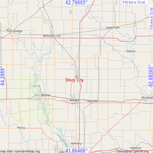
Story City GPS coordinates[2]
42° 11' 13.956" North, 93° 35' 44.772" West
| Map corner | latitude | longitude |
|---|---|---|
| Upper-left | 42.70605°, | -94.2989° |
| Center: | 42.18721°, | -93.59577° |
| Lower-right: | 41.66408°, | -92.89265° |
| Map W x H: | 115.9×115.9 km | = 72×72mi |
| max Lat: | 71.29058° ⇑22.8% North |
| Story City: | 42.18721° |
| min Lat: | ⇓77.2% South 19.06759° |
| min Long | Story City | max Long |
| -171.73463° | -93.59577° | -66.98998° |
| W 32.2%⇐ | ⇒67.8% E |
Elevation
Elevation of Story City is 310 m = 1017 ft, and this is 15.2 m = 50 ft above average elevation for this country.
| Max E: |
3189 m = 10463 ft | 25.5% |
| Story City | 310 m 1017 ft | |
| Avg. | 294.8 m = 967 ft | |
Min E: |
-60 m = -197 ft | 74.5% |
See also: United States elevation on elevation.city.
Geographical zone
Story City is located in North temperate zone (between Tropic of Cancer and the Arctic Circle). Distance of this Northern Tropic circle is 2084.9 km =1295.5 mi to South.| Distance of | km | miles | from Story City |
|---|---|---|---|
| North Pole | 5316.3 | 3303.4 | to North |
| Arctic Circle | 2710.4 | 1684.2 | to North |
| Tropic Cancer | 2084.9 | 1295.5 | to South |
| Equator | 4690.8 | 2914.7 | to South |


Nearby cities:
15 places around Story City: (largest is in red/bold)
• Ames
17.1 km =10.6 mi,  186°
186°
• Boone
27.4 km =17 mi,  238°
238°
• Cambridge
32.6 km =20.3 mi,  170°
170°
• Centerville
29.9 km =18.6 mi,  249°
249°
• Colo
29.8 km =18.5 mi,  129°
129°
• Ellsworth
14 km =8.7 mi,  5°
5°
• Gilbert
10 km =6.2 mi,  206°
206°
• Hubbard
27.7 km =17.2 mi,  61°
61°
• Huxley
32.5 km =20.2 mi,  180°
180°
• Jewell
13.8 km =8.6 mi,  344°
344°
• Nevada
21.8 km =13.5 mi,  147°
147°
• Radcliffe
19.5 km =12.1 mi,  43°
43°
• Roland
8.1 km =5 mi,  106°
106°
• Stratford
28.8 km =17.9 mi,  288°
288°
• Zearing
24.8 km =15.4 mi,  96°
96°
Sources, notices
• [Note1] Compared only with cities in United States existing in our database
• [Src1] Map data: © OpenStreetMap contributors (CC-BY-SA)
• [Src2] Other city data from geonames.org with taken over terms of usage.
• [Src3] Geographical zone / Annual Mean Temperature by Robert A. Rohde @ Wikipedia
