Toluca geodata
Toluca (Illinois) is a populated place; located in United States in America/Chicago (GMT-5) time zone. With population of 1,330 people, there are 14437 cities with bigger population in this country. Compared to other cities in United States, 65.9% of cities are located further ↓South; 56.6% of cities are located further →East and 53.5% of cities have lower elevation than Toluca. Note1
Administrative division(s):
- Level 1: Illinois
- Level 2: Marshall County
- Level 3: Township of Bennington


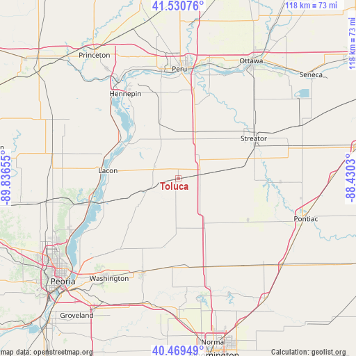
Toluca GPS coordinates[2]
41° 0' 8.136" North, 89° 8' 0.312" West
| Map corner | latitude | longitude |
|---|---|---|
| Upper-left | 41.53076°, | -89.83655° |
| Center: | 41.00226°, | -89.13342° |
| Lower-right: | 40.46949°, | -88.4303° |
| Map W x H: | 118×118 km | = 73.3×73.3mi |
| max Lat: | 71.29058° ⇑34.1% North |
| Toluca: | 41.00226° |
| min Lat: | ⇓65.9% South 19.06759° |
| min Long | Toluca | max Long |
| -171.73463° | -89.13342° | -66.98998° |
| W 43.4%⇐ | ⇒56.6% E |
Elevation
Elevation of Toluca is 212 m = 696 ft, and this is 82.8 m = 272 ft below average elevation for this country.
| Max E: |
3189 m = 10463 ft | 46.5% |
| Avg. | 294.8 m = 967 ft | |
| Toluca | 212 m = 696 ft | |
Min E: |
-60 m = -197 ft | 53.5% |
See also: United States elevation on elevation.city.
Geographical zone
Toluca is located in North temperate zone (between Tropic of Cancer and the Arctic Circle). Distance of this Northern Tropic circle is 1953.1 km =1213.6 mi to South.| Distance of | km | miles | from Toluca |
|---|---|---|---|
| North Pole | 5448 | 3385.2 | to North |
| Arctic Circle | 2842.2 | 1766.1 | to North |
| Tropic Cancer | 1953.1 | 1213.6 | to South |
| Equator | 4559 | 2832.8 | to South |


Nearby cities:
15 places around Toluca: (largest is in red/bold)
• Chillicothe
30.9 km =19.2 mi,  253°
253°
• El Paso
30.9 km =19.2 mi,  161°
161°
• Flanagan
26.7 km =16.6 mi,  121°
121°
• Granville
29.8 km =18.5 mi,  344°
344°
• Hennepin
33 km =20.5 mi,  328°
328°
• Henry
22.3 km =13.9 mi,  302°
302°
• Lacon
23.4 km =14.5 mi,  276°
276°
• Mark
30.7 km =19.1 mi, 341°
• Metamora
30.3 km =18.8 mi,  219°
219°
• Minonk
13.7 km =8.5 mi,  142°
142°
• Roanoke
23.5 km =14.6 mi,  193°
193°
• Streator
28.3 km =17.6 mi,  62°
62°
• Tonica
24.4 km =15.2 mi,  13°
13°
• Washburn
16.1 km =10 mi,  235°
235°
• Wenona
8.9 km =5.5 mi,  51°
51°
Sources, notices
• [Note1] Compared only with cities in United States existing in our database
• [Src1] Map data: © OpenStreetMap contributors (CC-BY-SA)
• [Src2] Other city data from geonames.org with taken over terms of usage.
• [Src3] Geographical zone / Annual Mean Temperature by Robert A. Rohde @ Wikipedia
