Stockwell geodata
Stockwell (Indiana) is a populated place; located in United States in America/Indiana/Indianapolis (GMT-4) time zone. With population of 545 people, there are 20332 cities with bigger population in this country. Compared to other cities in United States, 56.4% of cities are located further ↓South; 50.9% of cities are located further ←West and 59.9% of cities have lower elevation than Stockwell. Note1
Administrative division(s):
- Level 1: Indiana
- Level 2: Tippecanoe County
- Level 3: Township of Lauramie


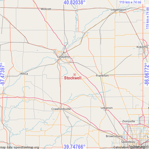
Stockwell GPS coordinates[2]
40° 17' 10.14" North, 86° 46' 15.024" West
| Map corner | latitude | longitude |
|---|---|---|
| Upper-left | 40.82038°, | -87.47397° |
| Center: | 40.28615°, | -86.77084° |
| Lower-right: | 39.74766°, | -86.06772° |
| Map W x H: | 119.3×119.3 km | = 74.1×74.1mi |
| max Lat: | 71.29058° ⇑43.6% North |
| Stockwell: | 40.28615° |
| min Lat: | ⇓56.4% South 19.06759° |
| min Long | Stockwell | max Long |
| -171.73463° | -86.77084° | -66.98998° |
| W 50.9%⇐ | ⇒49.1% E |
Elevation
Elevation of Stockwell is 239 m = 784 ft, and this is 55.8 m = 183 ft below average elevation for this country.
| Max E: |
3189 m = 10463 ft | 40.1% |
| Avg. | 294.8 m = 967 ft | |
| Stockwell | 239 m = 784 ft | |
Min E: |
-60 m = -197 ft | 59.9% |
See also: United States elevation on elevation.city.
Geographical zone
Stockwell is located in North temperate zone (between Tropic of Cancer and the Arctic Circle). Distance of this Northern Tropic circle is 1873.5 km =1164.1 mi to South.| Distance of | km | miles | from Stockwell |
|---|---|---|---|
| North Pole | 5527.7 | 3434.8 | to North |
| Arctic Circle | 2921.8 | 1815.5 | to North |
| Tropic Cancer | 1873.5 | 1164.1 | to South |
| Equator | 4479.4 | 2783.4 | to South |


Nearby cities:
15 places around Stockwell: (largest is in red/bold)
• Battle Ground
25.4 km =15.8 mi,  346°
346°
• Clarks Hill
5.8 km =3.6 mi,  138°
138°
• Colfax
13.4 km =8.3 mi, 139°
• Darlington
19.6 km =12.2 mi,  180°
180°
• Dayton
9.8 km =6.1 mi,  0°
0°
• Frankfort
22.1 km =13.7 mi,  91°
91°
• Lafayette
17 km =10.6 mi,  328°
328°
• Linden
15.7 km =9.8 mi,  226°
226°
• Monroe
3 km =1.9 mi, 89°
• Mulberry
11.1 km =6.9 mi,  54°
54°
• Rossville
20.8 km =12.9 mi, 45°
• Shadeland
18 km =11.2 mi,  302°
302°
• Thorntown
22.3 km =13.9 mi, 141°
• West Lafayette
19.4 km =12.1 mi,  323°
323°
• Westpoint
24 km =14.9 mi,  285°
285°
Sources, notices
• [Note1] Compared only with cities in United States existing in our database
• [Src1] Map data: © OpenStreetMap contributors (CC-BY-SA)
• [Src2] Other city data from geonames.org with taken over terms of usage.
• [Src3] Geographical zone / Annual Mean Temperature by Robert A. Rohde @ Wikipedia
