Battle Ground geodata
Battle Ground (Indiana) is a populated place; located in United States in America/Indiana/Indianapolis (GMT-4) time zone. With population of 1,474 people, there are 13776 cities with bigger population in this country. Compared to other cities in United States, 59% of cities are located further ↓South; 50.7% of cities are located further ←West and 54.8% of cities have higher elevation than Battle Ground. Note1
Administrative division(s):
- Level 1: Indiana
- Level 2: Tippecanoe County
- Level 3: Township of Tippecanoe


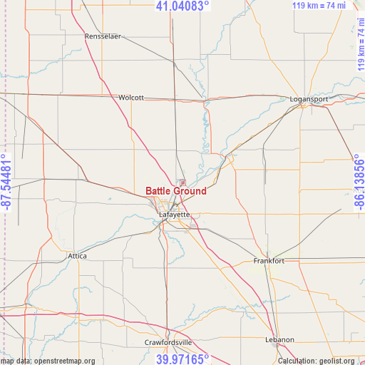
Battle Ground GPS coordinates[2]
40° 30' 30.132" North, 86° 50' 30.048" West
| Map corner | latitude | longitude |
|---|---|---|
| Upper-left | 41.04083°, | -87.54481° |
| Center: | 40.50837°, | -86.84168° |
| Lower-right: | 39.97165°, | -86.13856° |
| Map W x H: | 118.9×118.9 km | = 73.9×73.9mi |
| max Lat: | 71.29058° ⇑41% North |
| Battle Ground: | 40.50837° |
| min Lat: | ⇓59% South 19.06759° |
| min Long | Battle Ground | max Long |
| -171.73463° | -86.84168° | -66.98998° |
| W 50.7%⇐ | ⇒49.3% E |
Elevation
Elevation of Battle Ground is 181 m = 594 ft, and this is 113.8 m = 373 ft below average elevation for this country.
| Max E: |
3189 m = 10463 ft | 54.8% |
| Avg. | 294.8 m = 967 ft | |
| Battle Ground | 181 m = 594 ft | |
Min E: |
-60 m = -197 ft | 45.2% |
See also: United States elevation on elevation.city.
Geographical zone
Battle Ground is located in North temperate zone (between Tropic of Cancer and the Arctic Circle). Distance of this Northern Tropic circle is 1898.2 km =1179.5 mi to South.| Distance of | km | miles | from Battle Ground |
|---|---|---|---|
| North Pole | 5503 | 3419.4 | to North |
| Arctic Circle | 2897.1 | 1800.2 | to North |
| Tropic Cancer | 1898.2 | 1179.5 | to South |
| Equator | 4504.1 | 2798.7 | to South |


Nearby cities:
15 places around Battle Ground: (largest is in red/bold)
• Brookston
10.7 km =6.6 mi,  348°
348°
• Chalmers
17.4 km =10.8 mi, 352°
• Dayton
16.1 km =10 mi,  157°
157°
• Delphi
16.6 km =10.3 mi,  57°
57°
• Lafayette
10.6 km =6.6 mi,  195°
195°
• Monroe
26.3 km =16.3 mi, 159°
• Monticello
27.1 km =16.8 mi,  13°
13°
• Mulberry
23.6 km =14.7 mi,  140°
140°
• Otterbein
21.6 km =13.4 mi,  264°
264°
• Reynolds
26.9 km =16.7 mi, 354°
• Rossville
23.2 km =14.4 mi,  115°
115°
• Shadeland
17.5 km =10.9 mi,  211°
211°
• Stockwell
25.4 km =15.8 mi,  166°
166°
• West Lafayette
10.8 km =6.7 mi, 211°
• Westpoint
24.9 km =15.5 mi,  223°
223°
Sources, notices
• [Note1] Compared only with cities in United States existing in our database
• [Src1] Map data: © OpenStreetMap contributors (CC-BY-SA)
• [Src2] Other city data from geonames.org with taken over terms of usage.
• [Src3] Geographical zone / Annual Mean Temperature by Robert A. Rohde @ Wikipedia
