Lafayette geodata
Lafayette (Indiana) is a seat of a second-order administrative division; located in United States in America/Indiana/Indianapolis (GMT-4) time zone. With population of 71,111 people, there are 584 cities with bigger population in this country. Compared to other cities in United States, 58.1% of cities are located further ↓South; 50.6% of cities are located further ←West and 54.2% of cities have lower elevation than Lafayette. Note1
Administrative division(s):
- Level 1: Indiana
- Level 2: Tippecanoe County
- Level 3: Township of Fairfield


Lafayette GPS coordinates[2]
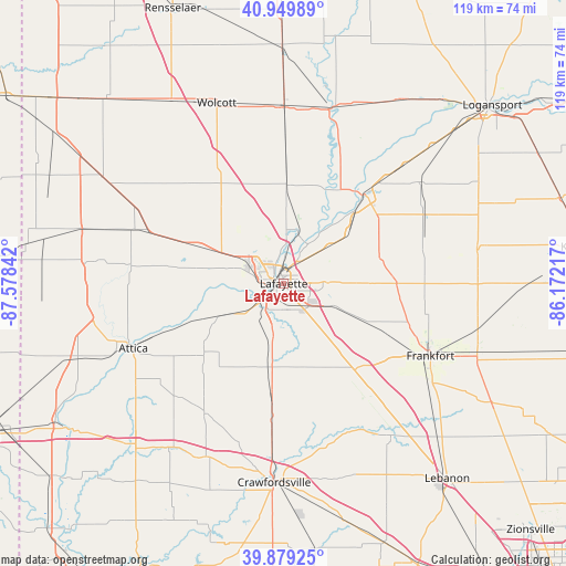
40° 25' 0.12" North, 86° 52' 31.044" West
| Map corner | latitude | longitude |
|---|---|---|
| Upper-left | 40.94989°, | -87.57842° |
| Center: | 40.4167°, | -86.87529° |
| Lower-right: | 39.87925°, | -86.17217° |
| Map W x H: | 119×119 km | = 73.9×73.9mi |
| max Lat: | 71.29058° ⇑41.9% North |
| Lafayette: | 40.4167° |
| min Lat: | ⇓58.1% South 19.06759° |
| min Long | Lafayette | max Long |
| -171.73463° | -86.87529° | -66.98998° |
| W 50.6%⇐ | ⇒49.4% E |
Elevation
Elevation of Lafayette is 215 m = 705 ft, and this is 79.8 m = 262 ft below average elevation for this country.
| Max E: |
3189 m = 10463 ft | 45.8% |
| Avg. | 294.8 m = 967 ft | |
| Lafayette | 215 m = 705 ft | |
Min E: |
-60 m = -197 ft | 54.2% |
See also: Lafayette elevation on elevation.city.
Geographical zone
Lafayette is located in North temperate zone (between Tropic of Cancer and the Arctic Circle). Distance of this Northern Tropic circle is 1888 km =1173.1 mi to South.| Distance of | km | miles | from Lafayette |
|---|---|---|---|
| North Pole | 5513.1 | 3425.7 | to North |
| Arctic Circle | 2907.3 | 1806.5 | to North |
| Tropic Cancer | 1888 | 1173.1 | to South |
| Equator | 4493.9 | 2792.4 | to South |


Nearby cities:
15 places around Lafayette: (largest is in red/bold)
• Battle Ground
10.6 km =6.6 mi,  15°
15°
• Brookston
20.7 km =12.9 mi,  1°
1°
• Chalmers
27.4 km =17 mi, 1°
• Clarks Hill
22.8 km =14.2 mi,  145°
145°
• Dayton
10.2 km =6.3 mi,  117°
117°
• Delphi
25.4 km =15.8 mi,  41°
41°
• Linden
25.5 km =15.8 mi,  185°
185°
• Monroe
18.7 km =11.6 mi,  140°
140°
• Mulberry
19.5 km =12.1 mi,  114°
114°
• Otterbein
20.4 km =12.7 mi,  293°
293°
• Rossville
23.8 km =14.8 mi,  89°
89°
• Shadeland
7.9 km =4.9 mi,  232°
232°
• Stockwell
17 km =10.6 mi, 148°
• West Lafayette
3 km =1.9 mi, 290°
• Westpoint
16.3 km =10.1 mi,  240°
240°
Sources, notices
• [Note1] Compared only with cities in United States existing in our database
• [Src1] Map data: © OpenStreetMap contributors (CC-BY-SA)
• [Src2] Other city data from geonames.org with taken over terms of usage.
• [Src3] Geographical zone / Annual Mean Temperature by Robert A. Rohde @ Wikipedia
