Springfield geodata
Springfield (Massachusetts) is a populated place; located in United States in America/New_York (GMT-4) time zone. With population of 154,341 people, there are 183 cities with bigger population in this country. Compared to other cities in United States, 76.5% of cities are located further ↓South; 94.7% of cities are located further ←West and 79.5% of cities have higher elevation than Springfield. Note1
Administrative division(s):
- Level 1: Massachusetts
- Level 2: Hampden County
- Level 3: City of Springfield


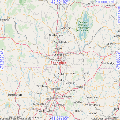
Springfield GPS coordinates[2]
42° 6' 5.328" North, 72° 35' 23.316" West
| Map corner | latitude | longitude |
|---|---|---|
| Upper-left | 42.62102°, | -73.29294° |
| Center: | 42.10148°, | -72.58981° |
| Lower-right: | 41.57765°, | -71.88669° |
| Map W x H: | 116×116 km | = 72.1×72.1mi |
| max Lat: | 71.29058° ⇑23.5% North |
| Springfield: | 42.10148° |
| min Lat: | ⇓76.5% South 19.06759° |
| min Long | Springfield | max Long |
| -171.73463° | -72.58981° | -66.98998° |
| W 94.7%⇐ | ⇒5.3% E |
Elevation
Elevation of Springfield is 49 m = 161 ft, and this is 245.8 m = 806 ft below average elevation for this country.
| Max E: |
3189 m = 10463 ft | 79.5% |
| Avg. | 294.8 m = 967 ft | |
| Springfield | 49 m = 161 ft | |
Min E: |
-60 m = -197 ft | 20.5% |
See also: Springfield elevation on elevation.city.
Geographical zone
Springfield is located in North temperate zone (between Tropic of Cancer and the Arctic Circle). Distance of this Northern Tropic circle is 2075.3 km =1289.5 mi to South.| Distance of | km | miles | from Springfield |
|---|---|---|---|
| North Pole | 5325.8 | 3309.3 | to North |
| Arctic Circle | 2719.9 | 1690.1 | to North |
| Tropic Cancer | 2075.3 | 1289.5 | to South |
| Equator | 4681.2 | 2908.8 | to South |


Nearby cities:
15 places around Springfield: (largest is in red/bold)
• Agawam
4.1 km =2.5 mi,  210°
210°
• Chicopee
5.5 km =3.4 mi,  344°
344°
• East Longmeadow
7.6 km =4.7 mi,  122°
122°
• Enfield
13.9 km =8.6 mi,  180°
180°
• Hazardville
13.2 km =8.2 mi,  163°
163°
• Holyoke
11.6 km =7.2 mi,  349°
349°
• Longmeadow
5.7 km =3.5 mi,  174°
174°
• Ludlow
11.4 km =7.1 mi,  55°
55°
• North Chicopee
9.1 km =5.7 mi, 354°
• Sherwood Manor
10 km =6.2 mi, 167°
• Suffield Depot
14.3 km =8.9 mi,  200°
200°
• Thompsonville
11.6 km =7.2 mi, 183°
• West Springfield
2.6 km =1.6 mi,  283°
283°
• Westfield
13.4 km =8.3 mi, 281°
• Wilbraham
13.3 km =8.3 mi,  79°
79°
Sources, notices
• [Note1] Compared only with cities in United States existing in our database
• [Src1] Map data: © OpenStreetMap contributors (CC-BY-SA)
• [Src2] Other city data from geonames.org with taken over terms of usage.
• [Src3] Geographical zone / Annual Mean Temperature by Robert A. Rohde @ Wikipedia
