Armada geodata
Armada (Michigan) is a populated place; located in United States in America/Detroit (GMT-4) time zone. With population of 1,744 people, there are 12756 cities with bigger population in this country. Compared to other cities in United States, 82.2% of cities are located further ↓South; 62.3% of cities are located further ←West and 57.9% of cities have lower elevation than Armada. Note1


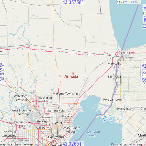
Armada GPS coordinates[2]
42° 50' 39.12" North, 82° 53' 3.732" West
| Map corner | latitude | longitude |
|---|---|---|
| Upper-left | 43.35758°, | -83.5875° |
| Center: | 42.8442°, | -82.88437° |
| Lower-right: | 42.32651°, | -82.18125° |
| Map W x H: | 114.6×114.6 km | = 71.2×71.2mi |
| max Lat: | 71.29058° ⇑17.8% North |
| Armada: | 42.8442° |
| min Lat: | ⇓82.2% South 19.06759° |
| min Long | Armada | max Long |
| -171.73463° | -82.88437° | -66.98998° |
| W 62.3%⇐ | ⇒37.7% E |
Elevation
Elevation of Armada is 230 m = 755 ft, and this is 64.8 m = 213 ft below average elevation for this country.
| Max E: |
3189 m = 10463 ft | 42.1% |
| Avg. | 294.8 m = 967 ft | |
| Armada | 230 m = 755 ft | |
Min E: |
-60 m = -197 ft | 57.9% |
See also: United States elevation on elevation.city.
Geographical zone
Armada is located in North temperate zone (between Tropic of Cancer and the Arctic Circle). Distance of this Northern Tropic circle is 2157.9 km =1340.9 mi to South.| Distance of | km | miles | from Armada |
|---|---|---|---|
| North Pole | 5243.2 | 3258 | to North |
| Arctic Circle | 2637.3 | 1638.7 | to North |
| Tropic Cancer | 2157.9 | 1340.9 | to South |
| Equator | 4763.8 | 2960.1 | to South |


Nearby cities:
15 places around Armada: (largest is in red/bold)
• Almont
15.6 km =9.7 mi,  302°
302°
• Capac
19.1 km =11.9 mi,  349°
349°
• Clinton Township
28.7 km =17.8 mi,  185°
185°
• Dryden
22.6 km =14 mi, 300°
• Imlay City
25.5 km =15.8 mi,  321°
321°
• Lake Orion
29.7 km =18.5 mi,  257°
257°
• Memphis
11.1 km =6.9 mi,  58°
58°
• Mount Clemens
27.5 km =17.1 mi,  178°
178°
• New Baltimore
21.8 km =13.5 mi,  146°
146°
• New Haven
14.4 km =8.9 mi, 152°
• Richmond
11.2 km =7 mi,  110°
110°
• Rochester
27.3 km =17 mi,  228°
228°
• Romeo
11.5 km =7.1 mi,  246°
246°
• Shelby
22.8 km =14.2 mi,  212°
212°
• Utica
27.1 km =16.8 mi, 206°
Sources, notices
• [Note1] Compared only with cities in United States existing in our database
• [Src1] Map data: © OpenStreetMap contributors (CC-BY-SA)
• [Src2] Other city data from geonames.org with taken over terms of usage.
• [Src3] Geographical zone / Annual Mean Temperature by Robert A. Rohde @ Wikipedia
