Hemlock geodata
Hemlock (Michigan) is a populated place; located in United States in America/Detroit (GMT-4) time zone. With population of 1,466 people, there are 13811 cities with bigger population in this country. Compared to other cities in United States, 85.9% of cities are located further ↓South; 58.5% of cities are located further ←West and 50.5% of cities have lower elevation than Hemlock. Note1


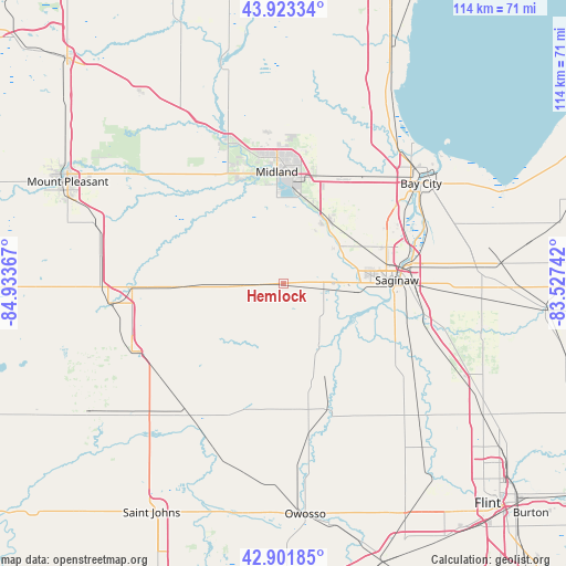
Hemlock GPS coordinates[2]
43° 24' 53.1" North, 84° 13' 49.944" West
| Map corner | latitude | longitude |
|---|---|---|
| Upper-left | 43.92334°, | -84.93367° |
| Center: | 43.41475°, | -84.23054° |
| Lower-right: | 42.90185°, | -83.52742° |
| Map W x H: | 113.6×113.6 km | = 70.6×70.6mi |
| max Lat: | 71.29058° ⇑14.1% North |
| Hemlock: | 43.41475° |
| min Lat: | ⇓85.9% South 19.06759° |
| min Long | Hemlock | max Long |
| -171.73463° | -84.23054° | -66.98998° |
| W 58.5%⇐ | ⇒41.5% E |
Elevation
Elevation of Hemlock is 200 m = 656 ft, and this is 94.8 m = 311 ft below average elevation for this country.
| Max E: |
3189 m = 10463 ft | 49.5% |
| Avg. | 294.8 m = 967 ft | |
| Hemlock | 200 m = 656 ft | |
Min E: |
-60 m = -197 ft | 50.5% |
See also: United States elevation on elevation.city.
Geographical zone
Hemlock is located in North temperate zone (between Tropic of Cancer and the Arctic Circle). Distance of this Northern Tropic circle is 2221.3 km =1380.3 mi to South.| Distance of | km | miles | from Hemlock |
|---|---|---|---|
| North Pole | 5179.8 | 3218.6 | to North |
| Arctic Circle | 2573.9 | 1599.3 | to North |
| Tropic Cancer | 2221.3 | 1380.3 | to South |
| Equator | 4827.3 | 2999.5 | to South |


Nearby cities:
15 places around Hemlock: (largest is in red/bold)
• Auburn
24.7 km =15.3 mi,  31°
31°
• Breckenridge
19.8 km =12.3 mi,  267°
267°
• Bridgeport
28.9 km =18 mi,  102°
102°
• Buena Vista
26.8 km =16.7 mi,  88°
88°
• Carrollton
24.7 km =15.3 mi,  78°
78°
• Chesaning
27.2 km =16.9 mi,  159°
159°
• Freeland
15 km =9.3 mi,  35°
35°
• Merrill
8 km =5 mi, 265°
• Midland
22.4 km =13.9 mi,  356°
356°
• Saginaw
22.6 km =14 mi, 88°
• Saginaw Township North
18.8 km =11.7 mi,  74°
74°
• Saint Charles
15 km =9.3 mi,  150°
150°
• Saint Louis
30.4 km =18.9 mi, 268°
• Shields
14.1 km =8.8 mi, 89°
• Zilwaukee
25.9 km =16.1 mi, 74°
Sources, notices
• [Note1] Compared only with cities in United States existing in our database
• [Src1] Map data: © OpenStreetMap contributors (CC-BY-SA)
• [Src2] Other city data from geonames.org with taken over terms of usage.
• [Src3] Geographical zone / Annual Mean Temperature by Robert A. Rohde @ Wikipedia
