Saginaw Township North geodata
Saginaw Township North (Michigan) is a populated place; located in United States in America/Detroit (GMT-4) time zone. With population of 24,994 people, there are 2006 cities with bigger population in this country. Compared to other cities in United States, 86.2% of cities are located further ↓South; 59.3% of cities are located further ←West and 51.9% of cities have higher elevation than Saginaw Township North. Note1
Administrative division(s):
- Level 1: Michigan
- Level 2: Saginaw County
- Level 3: Charter Township of Saginaw
Current local time in Saginaw Township North:
05:13 PM, WednesdayDifference from your time zone: hours


Saginaw Township North GPS coordinates[2]
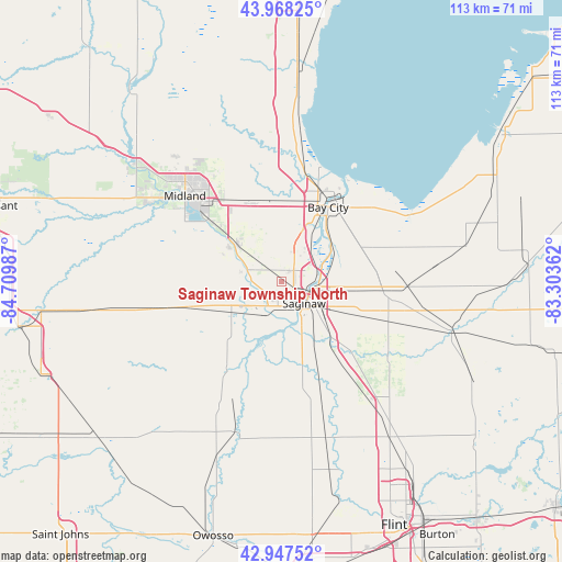
43° 27' 36.144" North, 84° 0' 24.264" West
| Map corner | latitude | longitude |
|---|---|---|
| Upper-left | 43.96825°, | -84.70987° |
| Center: | 43.46004°, | -84.00674° |
| Lower-right: | 42.94752°, | -83.30362° |
| Map W x H: | 113.5×113.5 km | = 70.5×70.5mi |
| max Lat: | 71.29058° ⇑13.8% North |
| Saginaw Township North: | 43.46004° |
| min Lat: | ⇓86.2% South 19.06759° |
| min Long | Saginaw Townshi | max Long |
| -171.73463° | -84.00674° | -66.98998° |
| W 59.3%⇐ | ⇒40.7% E |
Elevation
Elevation of Saginaw Township North is 191 m = 627 ft, and this is 103.8 m = 341 ft below average elevation for this country.
| Max E: |
3189 m = 10463 ft | 51.9% |
| Avg. | 294.8 m = 967 ft | |
| Saginaw Township North | 191 m = 627 ft | |
Min E: |
-60 m = -197 ft | 48.1% |
See also: United States elevation on elevation.city.
Geographical zone
Saginaw Township North is located in North temperate zone (between Tropic of Cancer and the Arctic Circle). Distance of this Northern Tropic circle is 2226.4 km =1383.4 mi to South.| Distance of | km | miles | from Saginaw Township North |
|---|---|---|---|
| North Pole | 5174.8 | 3215.5 | to North |
| Arctic Circle | 2568.9 | 1596.2 | to North |
| Tropic Cancer | 2226.4 | 1383.4 | to South |
| Equator | 4832.3 | 3002.7 | to South |


Nearby cities:
15 places around Saginaw Township North: (largest is in red/bold)
• Auburn
16.7 km =10.4 mi,  342°
342°
• Bay City
17.7 km =11 mi,  32°
32°
• Bridgeport
15.1 km =9.4 mi,  137°
137°
• Buena Vista
9.8 km =6.1 mi,  116°
116°
• Carrollton
6.2 km =3.9 mi,  91°
91°
• Essexville
21.8 km =13.5 mi,  37°
37°
• Frankenmuth
26 km =16.2 mi, 123°
• Freeland
11.8 km =7.3 mi,  307°
307°
• Hemlock
18.8 km =11.7 mi,  254°
254°
• Reese
25.1 km =15.6 mi, 92°
• Robin Glen-Indiantown
13.7 km =8.5 mi, 89°
• Saginaw
6.4 km =4 mi,  134°
134°
• Saint Charles
21.1 km =13.1 mi,  210°
210°
• Shields
6.4 km =4 mi,  218°
218°
• Zilwaukee
7.2 km =4.5 mi,  75°
75°
Sources, notices
• [Note1] Compared only with cities in United States existing in our database
• [Src1] Map data: © OpenStreetMap contributors (CC-BY-SA)
• [Src2] Other city data from geonames.org with taken over terms of usage.
• [Src3] Geographical zone / Annual Mean Temperature by Robert A. Rohde @ Wikipedia
