Portage geodata
Portage (Michigan) is a populated place; located in United States in America/Detroit (GMT-4) time zone. With population of 48,177 people, there are 997 cities with bigger population in this country. Compared to other cities in United States, 77.3% of cities are located further ↓South; 54.4% of cities are located further ←West and 67.4% of cities have lower elevation than Portage. Note1


Portage GPS coordinates[2]
42° 12' 4.14" North, 85° 34' 48" West
| Map corner | latitude | longitude |
|---|---|---|
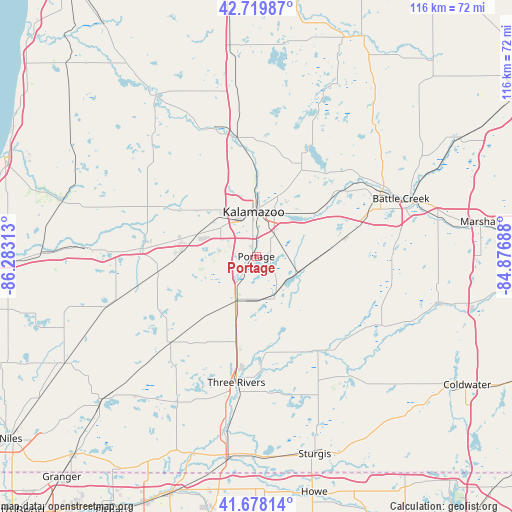
| Upper-left | 42.71987°, | -86.28313° |
| Center: | 42.20115°, | -85.58° |
| Lower-right: | 41.67814°, | -84.87688° |
| Map W x H: | 115.8×115.8 km | = 72×72mi |
| max Lat: | 71.29058° ⇑22.7% North |
| Portage: | 42.20115° |
| min Lat: | ⇓77.3% South 19.06759° |
| min Long | Portage | max Long |
| -171.73463° | -85.58° | -66.98998° |
| W 54.4%⇐ | ⇒45.6% E |
Elevation
Elevation of Portage is 273 m = 896 ft, and this is 21.8 m = 72 ft below average elevation for this country.
| Max E: |
3189 m = 10463 ft | 32.6% |
| Avg. | 294.8 m = 967 ft | |
| Portage | 273 m = 896 ft | |
Min E: |
-60 m = -197 ft | 67.4% |
See also: Portage elevation on elevation.city.
Geographical zone
Portage is located in North temperate zone (between Tropic of Cancer and the Arctic Circle). Distance of this Northern Tropic circle is 2086.4 km =1296.4 mi to South.| Distance of | km | miles | from Portage |
|---|---|---|---|
| North Pole | 5314.7 | 3302.4 | to North |
| Arctic Circle | 2708.8 | 1683.2 | to North |
| Tropic Cancer | 2086.4 | 1296.4 | to South |
| Equator | 4692.3 | 2915.7 | to South |


Nearby cities:
15 places around Portage: (largest is in red/bold)
• Augusta
24 km =14.9 mi,  51°
51°
• Climax
20.6 km =12.8 mi,  78°
78°
• Comstock Northwest
14.4 km =8.9 mi,  20°
20°
• Eastwood
11.6 km =7.2 mi,  12°
12°
• Galesburg
16.5 km =10.3 mi, 53°
• Kalamazoo
10.1 km =6.3 mi,  356°
356°
• Lawton
22.3 km =13.9 mi,  260°
260°
• Mattawan
16.9 km =10.5 mi,  273°
273°
• Mendon
24.2 km =15 mi,  153°
153°
• Parchment
14.1 km =8.8 mi,  3°
3°
• Richland
22 km =13.7 mi,  27°
27°
• Schoolcraft
10.8 km =6.7 mi,  206°
206°
• South Gull Lake
25.6 km =15.9 mi,  36°
36°
• Vicksburg
9.8 km =6.1 mi,  156°
156°
• Westwood
12.1 km =7.5 mi,  338°
338°
Sources, notices
• [Note1] Compared only with cities in United States existing in our database
• [Src1] Map data: © OpenStreetMap contributors (CC-BY-SA)
• [Src2] Other city data from geonames.org with taken over terms of usage.
• [Src3] Geographical zone / Annual Mean Temperature by Robert A. Rohde @ Wikipedia
