Saint Clair geodata
Saint Clair (Michigan) is a populated place; located in United States in America/Detroit (GMT-4) time zone. With population of 5,485 people, there are 6776 cities with bigger population in this country. Compared to other cities in United States, 82% of cities are located further ↓South; 63.9% of cities are located further ←West and 55.5% of cities have higher elevation than Saint Clair. Note1
Administrative division(s):
- Level 1: Michigan
- Level 2: Saint Clair County
- Level 3: City of Saint Clair


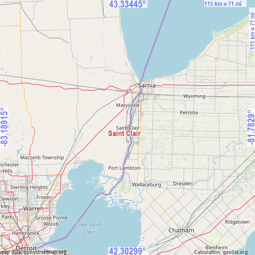
Saint Clair GPS coordinates[2]
42° 49' 15.132" North, 82° 29' 9.672" West
| Map corner | latitude | longitude |
|---|---|---|
| Upper-left | 43.33445°, | -83.18915° |
| Center: | 42.82087°, | -82.48602° |
| Lower-right: | 42.30299°, | -81.7829° |
| Map W x H: | 114.7×114.7 km | = 71.3×71.3mi |
| max Lat: | 71.29058° ⇑18% North |
| Saint Clair: | 42.82087° |
| min Lat: | ⇓82% South 19.06759° |
| min Long | Saint Clair | max Long |
| -171.73463° | -82.48602° | -66.98998° |
| W 63.9%⇐ | ⇒36.1% E |
Elevation
Elevation of Saint Clair is 178 m = 584 ft, and this is 116.8 m = 383 ft below average elevation for this country.
| Max E: |
3189 m = 10463 ft | 55.5% |
| Avg. | 294.8 m = 967 ft | |
| Saint Clair | 178 m = 584 ft | |
Min E: |
-60 m = -197 ft | 44.5% |
See also: United States elevation on elevation.city.
Geographical zone
Saint Clair is located in North temperate zone (between Tropic of Cancer and the Arctic Circle). Distance of this Northern Tropic circle is 2155.3 km =1339.2 mi to South.| Distance of | km | miles | from Saint Clair |
|---|---|---|---|
| North Pole | 5245.8 | 3259.6 | to North |
| Arctic Circle | 2639.9 | 1640.4 | to North |
| Tropic Cancer | 2155.3 | 1339.2 | to South |
| Equator | 4761.2 | 2958.5 | to South |


Nearby cities:
15 places around Saint Clair: (largest is in red/bold)
• Algonac
22.8 km =14.2 mi,  189°
189°
• Armada
32.6 km =20.3 mi,  274°
274°
• Capac
41.8 km =26 mi,  300°
300°
• Clinton Township
44 km =27.3 mi,  233°
233°
• Marine City
11.3 km =7 mi,  182°
182°
• Marysville
10.2 km =6.3 mi,  359°
359°
• Memphis
24.5 km =15.2 mi,  290°
290°
• Mount Clemens
40.5 km =25.2 mi, 232°
• New Baltimore
25.7 km =16 mi, 232°
• New Haven
27.7 km =17.2 mi,  248°
248°
• Pearl Beach
23.4 km =14.5 mi,  202°
202°
• Port Huron
17.4 km =10.8 mi,  16°
16°
• Richmond
22 km =13.7 mi, 266°
• Romeo
43 km =26.7 mi, 267°
• Yale
42.7 km =26.5 mi,  323°
323°
Sources, notices
• [Note1] Compared only with cities in United States existing in our database
• [Src1] Map data: © OpenStreetMap contributors (CC-BY-SA)
• [Src2] Other city data from geonames.org with taken over terms of usage.
• [Src3] Geographical zone / Annual Mean Temperature by Robert A. Rohde @ Wikipedia
