Stockbridge geodata
Stockbridge (Michigan) is a populated place; located in United States in America/Detroit (GMT-4) time zone. With population of 1,232 people, there are 14940 cities with bigger population in this country. Compared to other cities in United States, 79.3% of cities are located further ↓South; 58.7% of cities are located further ←West and 70.3% of cities have lower elevation than Stockbridge. Note1
Administrative division(s):
- Level 1: Michigan
- Level 2: Ingham County
- Level 3: Township of Stockbridge


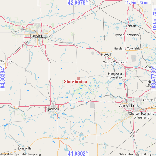
Stockbridge GPS coordinates[2]
42° 27' 4.14" North, 84° 10' 49.836" West
| Map corner | latitude | longitude |
|---|---|---|
| Upper-left | 42.9678°, | -84.88364° |
| Center: | 42.45115°, | -84.18051° |
| Lower-right: | 41.9302°, | -83.47739° |
| Map W x H: | 115.4×115.4 km | = 71.7×71.7mi |
| max Lat: | 71.29058° ⇑20.7% North |
| Stockbridge: | 42.45115° |
| min Lat: | ⇓79.3% South 19.06759° |
| min Long | Stockbridge | max Long |
| -171.73463° | -84.18051° | -66.98998° |
| W 58.7%⇐ | ⇒41.3% E |
Elevation
Elevation of Stockbridge is 287 m = 942 ft, and this is 7.8 m = 26 ft below average elevation for this country.
| Max E: |
3189 m = 10463 ft | 29.7% |
| Avg. | 294.8 m = 967 ft | |
| Stockbridge | 287 m = 942 ft | |
Min E: |
-60 m = -197 ft | 70.3% |
See also: United States elevation on elevation.city.
Geographical zone
Stockbridge is located in North temperate zone (between Tropic of Cancer and the Arctic Circle). Distance of this Northern Tropic circle is 2114.2 km =1313.7 mi to South.| Distance of | km | miles | from Stockbridge |
|---|---|---|---|
| North Pole | 5286.9 | 3285.1 | to North |
| Arctic Circle | 2681 | 1665.9 | to North |
| Tropic Cancer | 2114.2 | 1313.7 | to South |
| Equator | 4720.1 | 2932.9 | to South |


Nearby cities:
15 places around Stockbridge: (largest is in red/bold)
• Chelsea
19.7 km =12.2 mi,  138°
138°
• Dansville
15.4 km =9.6 mi,  319°
319°
• Dexter
27 km =16.8 mi,  117°
117°
• Fowlerville
24.9 km =15.5 mi,  20°
20°
• Grass Lake
22.4 km =13.9 mi,  186°
186°
• Howell
26.9 km =16.7 mi,  49°
49°
• Jackson
29.2 km =18.1 mi,  218°
218°
• Leslie
20.7 km =12.9 mi,  270°
270°
• Mason
25.8 km =16 mi,  303°
303°
• Michigan Center
27.1 km =16.8 mi,  206°
206°
• Napoleon
32.8 km =20.4 mi, 189°
• Pinckney
19.1 km =11.9 mi,  88°
88°
• Vandercook Lake
33.5 km =20.8 mi, 211°
• Webberville
24 km =14.9 mi,  1°
1°
• Williamston
27.7 km =17.2 mi,  342°
342°
Sources, notices
• [Note1] Compared only with cities in United States existing in our database
• [Src1] Map data: © OpenStreetMap contributors (CC-BY-SA)
• [Src2] Other city data from geonames.org with taken over terms of usage.
• [Src3] Geographical zone / Annual Mean Temperature by Robert A. Rohde @ Wikipedia
