Babbitt geodata
Babbitt (Minnesota) is a populated place; located in United States in America/Chicago (GMT-5) time zone. With population of 1,519 people, there are 13587 cities with bigger population in this country. Compared to other cities in United States, 98.1% of cities are located further ↓South; 64% of cities are located further →East and 86.4% of cities have lower elevation than Babbitt. Note1


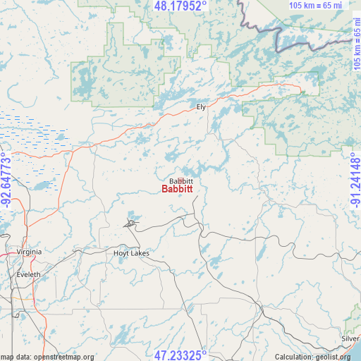
Babbitt GPS coordinates[2]
47° 42' 30.708" North, 91° 56' 40.56" West
| Map corner | latitude | longitude |
|---|---|---|
| Upper-left | 48.17952°, | -92.64773° |
| Center: | 47.70853°, | -91.9446° |
| Lower-right: | 47.23325°, | -91.24148° |
| Map W x H: | 105.2×105.2 km | = 65.4×65.4mi |
| max Lat: | 71.29058° ⇑1.9% North |
| Babbitt: | 47.70853° |
| min Lat: | ⇓98.1% South 19.06759° |
| min Long | Babbitt | max Long |
| -171.73463° | -91.9446° | -66.98998° |
| W 36%⇐ | ⇒64% E |
Elevation
Elevation of Babbitt is 451 m = 1480 ft, and this is 156.2 m = 512 ft above average elevation for this country.
| Max E: |
3189 m = 10463 ft | 13.6% |
| Babbitt | 451 m 1480 ft | |
| Avg. | 294.8 m = 967 ft | |
Min E: |
-60 m = -197 ft | 86.4% |
See also: United States elevation on elevation.city.
Geographical zone
Babbitt is located in North temperate zone (between Tropic of Cancer and the Arctic Circle). Distance of this North polar circle is 2096.5 km =1302.7 mi to North.| Distance of | km | miles | from Babbitt |
|---|---|---|---|
| North Pole | 4702.4 | 2921.9 | to North |
| Arctic Circle | 2096.5 | 1302.7 | to North |
| Tropic Cancer | 2698.8 | 1677 | to South |
| Equator | 5304.7 | 3296.2 | to South |


Nearby cities:
15 places around Babbitt: (largest is in red/bold)
• Aurora
29.6 km =18.4 mi,  227°
227°
• Biwabik
35.5 km =22.1 mi,  236°
236°
• Buhl
66.9 km =41.6 mi,  249°
249°
• Chisholm
74.5 km =46.3 mi, 250°
• Cook
57.9 km =36 mi,  286°
286°
• Ely
22.4 km =13.9 mi,  14°
14°
• Eveleth
52.4 km =32.6 mi, 238°
• Gilbert
46 km =28.6 mi, 237°
• Hibbing
80.8 km =50.2 mi, 247°
• Hoyt Lakes
25.5 km =15.8 mi,  214°
214°
• Mountain Iron
54.5 km =33.9 mi, 248°
• Parkville
51.5 km =32 mi, 247°
• Silver Bay
69.2 km =43 mi,  131°
131°
• Two Harbors
79 km =49.1 mi,  164°
164°
• Virginia
48.9 km =30.4 mi, 245°
Sources, notices
• [Note1] Compared only with cities in United States existing in our database
• [Src1] Map data: © OpenStreetMap contributors (CC-BY-SA)
• [Src2] Other city data from geonames.org with taken over terms of usage.
• [Src3] Geographical zone / Annual Mean Temperature by Robert A. Rohde @ Wikipedia
