Parkville geodata
Parkville (Minnesota) is a populated place; located in United States in America/Chicago (GMT-5) time zone. With population of 2,525 people, there are 10554 cities with bigger population in this country. Compared to other cities in United States, 97.7% of cities are located further ↓South; 65.4% of cities are located further →East and 85.8% of cities have lower elevation than Parkville. Note1
Administrative division(s):
- Level 1: Minnesota
- Level 2: Saint Louis County
- Level 3: City of Mountain Iron


Parkville GPS coordinates[2]
47° 31' 51.744" North, 92° 34' 44.652" West
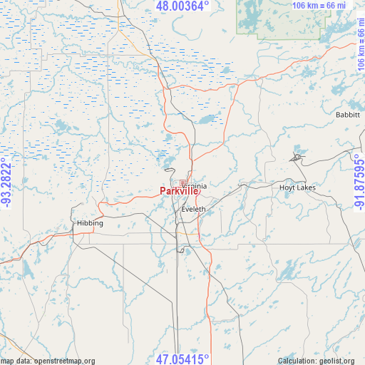
| Map corner | latitude | longitude |
|---|---|---|
| Upper-left | 48.00364°, | -93.2822° |
| Center: | 47.53104°, | -92.57907° |
| Lower-right: | 47.05415°, | -91.87595° |
| Map W x H: | 105.6×105.6 km | = 65.6×65.6mi |
| max Lat: | 71.29058° ⇑2.3% North |
| Parkville: | 47.53104° |
| min Lat: | ⇓97.7% South 19.06759° |
| min Long | Parkville | max Long |
| -171.73463° | -92.57907° | -66.98998° |
| W 34.6%⇐ | ⇒65.4% E |
Elevation
Elevation of Parkville is 439 m = 1440 ft, and this is 144.2 m = 473 ft above average elevation for this country.
| Max E: |
3189 m = 10463 ft | 14.2% |
| Parkville | 439 m 1440 ft | |
| Avg. | 294.8 m = 967 ft | |
Min E: |
-60 m = -197 ft | 85.8% |
See also: United States elevation on elevation.city.
Geographical zone
Parkville is located in North temperate zone (between Tropic of Cancer and the Arctic Circle). Distance of this North polar circle is 2116.2 km =1314.9 mi to North.| Distance of | km | miles | from Parkville |
|---|---|---|---|
| North Pole | 4722.1 | 2934.2 | to North |
| Arctic Circle | 2116.2 | 1314.9 | to North |
| Tropic Cancer | 2679 | 1664.7 | to South |
| Equator | 5285 | 3283.9 | to South |


Nearby cities:
15 places around Parkville: (largest is in red/bold)
• Aurora
25.7 km =16 mi,  90°
90°
• Babbitt
51.5 km =32 mi,  67°
67°
• Biwabik
17.9 km =11.1 mi, 89°
• Buhl
15.5 km =9.6 mi,  254°
254°
• Chisholm
23.4 km =14.5 mi,  258°
258°
• Cook
36.7 km =22.8 mi,  346°
346°
• Eveleth
8.2 km =5.1 mi,  158°
158°
• Gilbert
9.8 km =6.1 mi,  118°
118°
• Hibbing
29.3 km =18.2 mi, 246°
• Hoyt Lakes
33.1 km =20.6 mi, 92°
• Keewatin
39.9 km =24.8 mi, 248°
• Marble
59 km =36.7 mi, 246°
• Mountain Iron
3.3 km =2.1 mi,  272°
272°
• Nashwauk
47.4 km =29.5 mi, 249°
• Virginia
3.3 km =2.1 mi,  105°
105°
Sources, notices
• [Note1] Compared only with cities in United States existing in our database
• [Src1] Map data: © OpenStreetMap contributors (CC-BY-SA)
• [Src2] Other city data from geonames.org with taken over terms of usage.
• [Src3] Geographical zone / Annual Mean Temperature by Robert A. Rohde @ Wikipedia
