Two Harbors geodata
Two Harbors (Minnesota) is a seat of a second-order administrative division; located in United States in America/Chicago (GMT-5) time zone. With population of 3,578 people, there are 8756 cities with bigger population in this country. Compared to other cities in United States, 96.7% of cities are located further ↓South; 63.4% of cities are located further →East and 52.2% of cities have lower elevation than Two Harbors. Note1


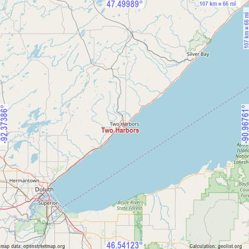
Two Harbors GPS coordinates[2]
47° 1' 21.756" North, 91° 40' 14.628" West
| Map corner | latitude | longitude |
|---|---|---|
| Upper-left | 47.49989°, | -92.37386° |
| Center: | 47.02271°, | -91.67073° |
| Lower-right: | 46.54123°, | -90.96761° |
| Map W x H: | 106.6×106.6 km | = 66.2×66.2mi |
| max Lat: | 71.29058° ⇑3.3% North |
| Two Harbors: | 47.02271° |
| min Lat: | ⇓96.7% South 19.06759° |
| min Long | Two Harbors | max Long |
| -171.73463° | -91.67073° | -66.98998° |
| W 36.6%⇐ | ⇒63.4% E |
Elevation
Elevation of Two Harbors is 207 m = 679 ft, and this is 87.8 m = 288 ft below average elevation for this country.
| Max E: |
3189 m = 10463 ft | 47.8% |
| Avg. | 294.8 m = 967 ft | |
| Two Harbors | 207 m = 679 ft | |
Min E: |
-60 m = -197 ft | 52.2% |
See also: United States elevation on elevation.city.
Geographical zone
Two Harbors is located in North temperate zone (between Tropic of Cancer and the Arctic Circle). Distance of this North polar circle is 2172.7 km =1350.1 mi to North.| Distance of | km | miles | from Two Harbors |
|---|---|---|---|
| North Pole | 4778.6 | 2969.3 | to North |
| Arctic Circle | 2172.7 | 1350.1 | to North |
| Tropic Cancer | 2622.5 | 1629.5 | to South |
| Equator | 5228.4 | 3248.8 | to South |


Nearby cities:
15 places around Two Harbors: (largest is in red/bold)
• Arnold
35.6 km =22.1 mi,  243°
243°
• Carlton
69.9 km =43.4 mi, 235°
• Cloquet
68.7 km =42.7 mi, 240°
• Duluth
42.5 km =26.4 mi,  231°
231°
• Esko
63.4 km =39.4 mi, 236°
• Hermantown
49.3 km =30.6 mi, 240°
• Hoyt Lakes
65.6 km =40.8 mi,  327°
327°
• Iron River
54.7 km =34 mi,  158°
158°
• Lake Nebagamon
56.5 km =35.1 mi,  182°
182°
• Poplar
49.8 km =30.9 mi,  191°
191°
• Proctor
52.1 km =32.4 mi, 233°
• Scanlon
67.5 km =41.9 mi, 238°
• Silver Bay
43.5 km =27 mi,  45°
45°
• Superior
47 km =29.2 mi,  224°
224°
• Superior Village
52.4 km =32.6 mi, 219°
Sources, notices
• [Note1] Compared only with cities in United States existing in our database
• [Src1] Map data: © OpenStreetMap contributors (CC-BY-SA)
• [Src2] Other city data from geonames.org with taken over terms of usage.
• [Src3] Geographical zone / Annual Mean Temperature by Robert A. Rohde @ Wikipedia
