Dodge Center geodata
Dodge Center (Minnesota) is a populated place; located in United States in America/Chicago (GMT-5) time zone. With population of 2,690 people, there are 10203 cities with bigger population in this country. Compared to other cities in United States, 88.5% of cities are located further ↓South; 66% of cities are located further →East and 83.3% of cities have lower elevation than Dodge Center. Note1


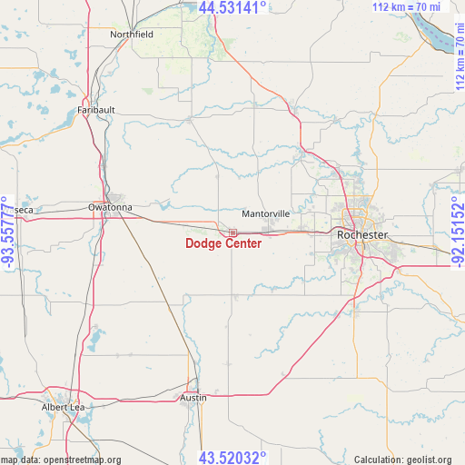
Dodge Center GPS coordinates[2]
44° 1' 40.872" North, 92° 51' 16.704" West
| Map corner | latitude | longitude |
|---|---|---|
| Upper-left | 44.53141°, | -93.55777° |
| Center: | 44.02802°, | -92.85464° |
| Lower-right: | 43.52032°, | -92.15152° |
| Map W x H: | 112.4×112.4 km | = 69.8×69.8mi |
| max Lat: | 71.29058° ⇑11.5% North |
| Dodge Center: | 44.02802° |
| min Lat: | ⇓88.5% South 19.06759° |
| min Long | Dodge Center | max Long |
| -171.73463° | -92.85464° | -66.98998° |
| W 34%⇐ | ⇒66% E |
Elevation
Elevation of Dodge Center is 395 m = 1296 ft, and this is 100.2 m = 329 ft above average elevation for this country.
| Max E: |
3189 m = 10463 ft | 16.7% |
| Dodge Center | 395 m 1296 ft | |
| Avg. | 294.8 m = 967 ft | |
Min E: |
-60 m = -197 ft | 83.3% |
See also: United States elevation on elevation.city.
Geographical zone
Dodge Center is located in North temperate zone (between Tropic of Cancer and the Arctic Circle). Distance of this Northern Tropic circle is 2289.5 km =1422.6 mi to South.| Distance of | km | miles | from Dodge Center |
|---|---|---|---|
| North Pole | 5111.6 | 3176.2 | to North |
| Arctic Circle | 2505.7 | 1557 | to North |
| Tropic Cancer | 2289.5 | 1422.6 | to South |
| Equator | 4895.5 | 3041.9 | to South |


Nearby cities:
15 places around Dodge Center: (largest is in red/bold)
• Blooming Prairie
23.9 km =14.9 mi,  221°
221°
• Brownsdale
32 km =19.9 mi,  182°
182°
• Byron
16.7 km =10.4 mi,  88°
88°
• Claremont
11.6 km =7.2 mi,  279°
279°
• Hayfield
15.3 km =9.5 mi, 177°
• Kasson
8.3 km =5.2 mi, 88°
• Kenyon
29.1 km =18.1 mi,  338°
338°
• Mantorville
9.1 km =5.7 mi,  59°
59°
• Oronoco
29.8 km =18.5 mi, 58°
• Owatonna
30.3 km =18.8 mi, 281°
• Pine Island
25.5 km =15.8 mi,  40°
40°
• Rochester
30.8 km =19.1 mi, 91°
• Wanamingo
31.2 km =19.4 mi,  9°
9°
• West Concord
14.4 km =8.9 mi,  345°
345°
• Zumbrota
33.1 km =20.6 mi,  26°
26°
Sources, notices
• [Note1] Compared only with cities in United States existing in our database
• [Src1] Map data: © OpenStreetMap contributors (CC-BY-SA)
• [Src2] Other city data from geonames.org with taken over terms of usage.
• [Src3] Geographical zone / Annual Mean Temperature by Robert A. Rohde @ Wikipedia
