Hayfield geodata
Hayfield (Minnesota) is a populated place; located in United States in America/Chicago (GMT-5) time zone. With population of 1,320 people, there are 14488 cities with bigger population in this country. Compared to other cities in United States, 88% of cities are located further ↓South; 65.9% of cities are located further →East and 83.8% of cities have lower elevation than Hayfield. Note1


Hayfield GPS coordinates[2]
43° 53' 25.872" North, 92° 50' 51.684" West
| Map corner | latitude | longitude |
|---|---|---|
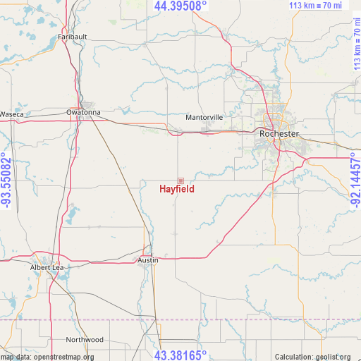
| Upper-left | 44.39508°, | -93.55082° |
| Center: | 43.89052°, | -92.84769° |
| Lower-right: | 43.38165°, | -92.14457° |
| Map W x H: | 112.7×112.7 km | = 70×70mi |
| max Lat: | 71.29058° ⇑12% North |
| Hayfield: | 43.89052° |
| min Lat: | ⇓88% South 19.06759° |
| min Long | Hayfield | max Long |
| -171.73463° | -92.84769° | -66.98998° |
| W 34.1%⇐ | ⇒65.9% E |
Elevation
Elevation of Hayfield is 401 m = 1316 ft, and this is 106.2 m = 348 ft above average elevation for this country.
| Max E: |
3189 m = 10463 ft | 16.2% |
| Hayfield | 401 m 1316 ft | |
| Avg. | 294.8 m = 967 ft | |
Min E: |
-60 m = -197 ft | 83.8% |
See also: United States elevation on elevation.city.
Geographical zone
Hayfield is located in North temperate zone (between Tropic of Cancer and the Arctic Circle). Distance of this Northern Tropic circle is 2274.2 km =1413.1 mi to South.| Distance of | km | miles | from Hayfield |
|---|---|---|---|
| North Pole | 5126.9 | 3185.7 | to North |
| Arctic Circle | 2521 | 1566.5 | to North |
| Tropic Cancer | 2274.2 | 1413.1 | to South |
| Equator | 4880.2 | 3032.4 | to South |


Nearby cities:
15 places around Hayfield: (largest is in red/bold)
• Austin
26.9 km =16.7 mi,  202°
202°
• Blooming Prairie
16.5 km =10.3 mi,  260°
260°
• Brownsdale
16.8 km =10.4 mi,  185°
185°
• Byron
22.6 km =14 mi,  45°
45°
• Claremont
20.9 km =13 mi,  324°
324°
• Dodge Center
15.3 km =9.5 mi,  357°
357°
• Ellendale
36.4 km =22.6 mi,  266°
266°
• Geneva
34.5 km =21.4 mi, 257°
• Grand Meadow
30.2 km =18.8 mi,  132°
132°
• Kasson
17.3 km =10.7 mi,  26°
26°
• Mantorville
21.2 km =13.2 mi,  20°
20°
• Racine
31.9 km =19.8 mi,  113°
113°
• Rochester
33.6 km =20.9 mi,  64°
64°
• Stewartville
29.1 km =18.1 mi,  97°
97°
• West Concord
29.5 km =18.3 mi,  351°
351°
Sources, notices
• [Note1] Compared only with cities in United States existing in our database
• [Src1] Map data: © OpenStreetMap contributors (CC-BY-SA)
• [Src2] Other city data from geonames.org with taken over terms of usage.
• [Src3] Geographical zone / Annual Mean Temperature by Robert A. Rohde @ Wikipedia
