Ponemah geodata
Ponemah (Minnesota) is a populated place; located in United States in America/Chicago (GMT-5) time zone. With population of 724 people, there are 18460 cities with bigger population in this country. Compared to other cities in United States, 98.6% of cities are located further ↓South; 70.9% of cities are located further →East and 80.8% of cities have lower elevation than Ponemah. Note1
Administrative division(s):
- Level 1: Minnesota
- Level 2: Beltrami County
- Level 3: Unorganized Territory of Lower Red Lake


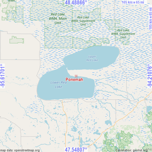
Ponemah GPS coordinates[2]
48° 1' 13.836" North, 94° 54' 49.968" West
| Map corner | latitude | longitude |
|---|---|---|
| Upper-left | 48.48866°, | -95.61701° |
| Center: | 48.02051°, | -94.91388° |
| Lower-right: | 47.54807°, | -94.21076° |
| Map W x H: | 104.6×104.6 km | = 65×65mi |
| max Lat: | 71.29058° ⇑1.4% North |
| Ponemah: | 48.02051° |
| min Lat: | ⇓98.6% South 19.06759° |
| min Long | Ponemah | max Long |
| -171.73463° | -94.91388° | -66.98998° |
| W 29.1%⇐ | ⇒70.9% E |
Elevation
Elevation of Ponemah is 362 m = 1188 ft, and this is 67.2 m = 220 ft above average elevation for this country.
| Max E: |
3189 m = 10463 ft | 19.2% |
| Ponemah | 362 m 1188 ft | |
| Avg. | 294.8 m = 967 ft | |
Min E: |
-60 m = -197 ft | 80.8% |
See also: United States elevation on elevation.city.
Geographical zone
Ponemah is located in North temperate zone (between Tropic of Cancer and the Arctic Circle). Distance of this North polar circle is 2061.8 km =1281.1 mi to North.| Distance of | km | miles | from Ponemah |
|---|---|---|---|
| North Pole | 4667.7 | 2900.4 | to North |
| Arctic Circle | 2061.8 | 1281.1 | to North |
| Tropic Cancer | 2733.5 | 1698.5 | to South |
| Equator | 5339.4 | 3317.7 | to South |


Nearby cities:
15 places around Ponemah: (largest is in red/bold)
• Bagley
66.2 km =41.1 mi,  213°
213°
• Baudette
80.4 km =50 mi,  16°
16°
• Bemidji
60.9 km =37.8 mi,  177°
177°
• Blackduck
42 km =26.1 mi,  139°
139°
• Cass Lake
75 km =46.6 mi,  161°
161°
• Clearbrook
53.1 km =33 mi,  226°
226°
• Fosston
79.7 km =49.5 mi, 231°
• Little Rock
22.4 km =13.9 mi,  220°
220°
• McIntosh
84.2 km =52.3 mi,  239°
239°
• Naytahwaush
99.7 km =62 mi, 212°
• Red Lake
17.8 km =11.1 mi, 205°
• Red Lake Falls
102.5 km =63.7 mi,  261°
261°
• Redby
15.8 km =9.8 mi, 179°
• Thief River Falls
94.8 km =58.9 mi,  276°
276°
• Warroad
102.7 km =63.8 mi,  343°
343°
Sources, notices
• [Note1] Compared only with cities in United States existing in our database
• [Src1] Map data: © OpenStreetMap contributors (CC-BY-SA)
• [Src2] Other city data from geonames.org with taken over terms of usage.
• [Src3] Geographical zone / Annual Mean Temperature by Robert A. Rohde @ Wikipedia
