Little Rock geodata
Little Rock (Minnesota) is a populated place; located in United States in America/Chicago (GMT-5) time zone. With population of 1,208 people, there are 15087 cities with bigger population in this country. Compared to other cities in United States, 98.4% of cities are located further ↓South; 71.4% of cities are located further →East and 81.3% of cities have lower elevation than Little Rock. Note1
Administrative division(s):
- Level 1: Minnesota
- Level 2: Beltrami County
- Level 3: Unorganized Territory of Lower Red Lake


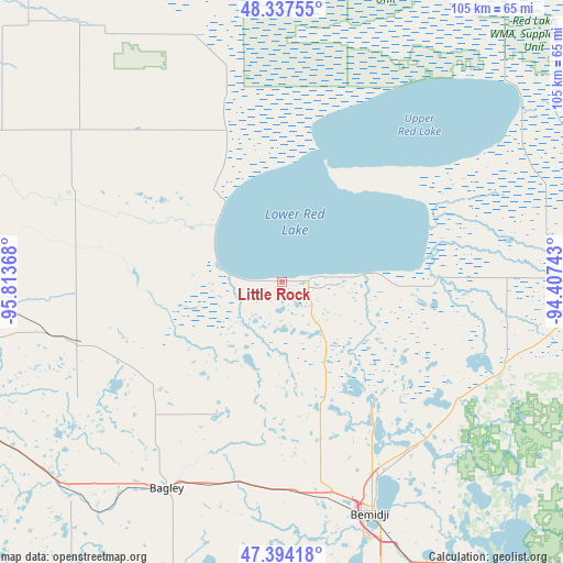
Little Rock GPS coordinates[2]
47° 52' 4.836" North, 95° 6' 37.98" West
| Map corner | latitude | longitude |
|---|---|---|
| Upper-left | 48.33755°, | -95.81368° |
| Center: | 47.86801°, | -95.11055° |
| Lower-right: | 47.39418°, | -94.40743° |
| Map W x H: | 104.9×104.9 km | = 65.2×65.2mi |
| max Lat: | 71.29058° ⇑1.6% North |
| Little Rock: | 47.86801° |
| min Lat: | ⇓98.4% South 19.06759° |
| min Long | Little Rock | max Long |
| -171.73463° | -95.11055° | -66.98998° |
| W 28.6%⇐ | ⇒71.4% E |
Elevation
Elevation of Little Rock is 368 m = 1207 ft, and this is 73.2 m = 240 ft above average elevation for this country.
| Max E: |
3189 m = 10463 ft | 18.7% |
| Little Rock | 368 m 1207 ft | |
| Avg. | 294.8 m = 967 ft | |
Min E: |
-60 m = -197 ft | 81.3% |
See also: United States elevation on elevation.city.
Geographical zone
Little Rock is located in North temperate zone (between Tropic of Cancer and the Arctic Circle). Distance of this North polar circle is 2078.8 km =1291.7 mi to North.| Distance of | km | miles | from Little Rock |
|---|---|---|---|
| North Pole | 4684.6 | 2910.9 | to North |
| Arctic Circle | 2078.8 | 1291.7 | to North |
| Tropic Cancer | 2716.5 | 1688 | to South |
| Equator | 5322.4 | 3307.2 | to South |


Nearby cities:
15 places around Little Rock: (largest is in red/bold)
• Bagley
44.1 km =27.4 mi,  209°
209°
• Bemidji
47.1 km =29.3 mi,  158°
158°
• Blackduck
44.6 km =27.7 mi,  109°
109°
• Cass Lake
66.3 km =41.2 mi,  145°
145°
• Clearbrook
30.9 km =19.2 mi,  230°
230°
• Fosston
57.9 km =36 mi,  235°
235°
• Mahnomen
89 km =55.3 mi, 226°
• McIntosh
63.4 km =39.4 mi,  246°
246°
• Naytahwaush
77.6 km =48.2 mi, 209°
• Ponemah
22.4 km =13.9 mi,  40°
40°
• Red Lake
7 km =4.3 mi,  82°
82°
• Red Lake Falls
86.8 km =53.9 mi,  271°
271°
• Redby
14.8 km =9.2 mi,  85°
85°
• Thief River Falls
84.4 km =52.4 mi,  289°
289°
• Walker
93.9 km =58.3 mi, 155°
Sources, notices
• [Note1] Compared only with cities in United States existing in our database
• [Src1] Map data: © OpenStreetMap contributors (CC-BY-SA)
• [Src2] Other city data from geonames.org with taken over terms of usage.
• [Src3] Geographical zone / Annual Mean Temperature by Robert A. Rohde @ Wikipedia
