Jamestown geodata
Jamestown (North Dakota) is a seat of a second-order administrative division; located in United States in America/Chicago (GMT-5) time zone. With population of 15,422 people, there are 3161 cities with bigger population in this country. Compared to other cities in United States, 96.5% of cities are located further ↓South; 79.7% of cities are located further →East and 85.1% of cities have lower elevation than Jamestown. Note1
Administrative division(s):
- Level 1: North Dakota
- Level 2: Stutsman County
- Level 3: City of Jamestown


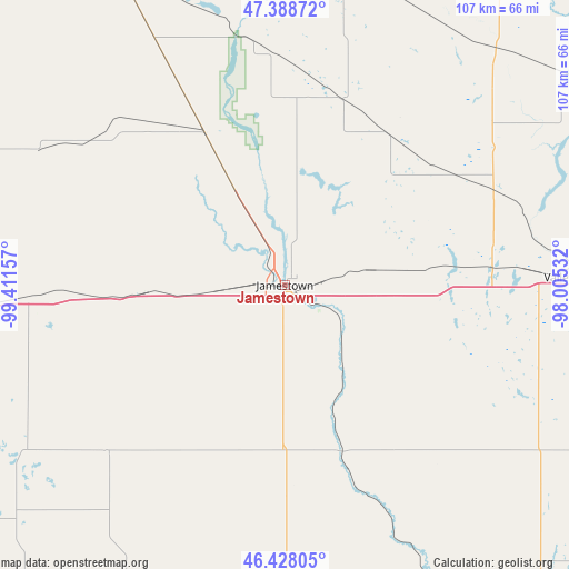
Jamestown GPS coordinates[2]
46° 54' 37.944" North, 98° 42' 30.384" West
| Map corner | latitude | longitude |
|---|---|---|
| Upper-left | 47.38872°, | -99.41157° |
| Center: | 46.91054°, | -98.70844° |
| Lower-right: | 46.42805°, | -98.00532° |
| Map W x H: | 106.8×106.8 km | = 66.4×66.4mi |
| max Lat: | 71.29058° ⇑3.5% North |
| Jamestown: | 46.91054° |
| min Lat: | ⇓96.5% South 19.06759° |
| min Long | Jamestown | max Long |
| -171.73463° | -98.70844° | -66.98998° |
| W 20.3%⇐ | ⇒79.7% E |
Elevation
Elevation of Jamestown is 427 m = 1401 ft, and this is 132.2 m = 434 ft above average elevation for this country.
| Max E: |
3189 m = 10463 ft | 14.9% |
| Jamestown | 427 m 1401 ft | |
| Avg. | 294.8 m = 967 ft | |
Min E: |
-60 m = -197 ft | 85.1% |
See also: United States elevation on elevation.city.
Geographical zone
Jamestown is located in North temperate zone (between Tropic of Cancer and the Arctic Circle). Distance of this North polar circle is 2185.2 km =1357.8 mi to North.| Distance of | km | miles | from Jamestown |
|---|---|---|---|
| North Pole | 4791.1 | 2977.1 | to North |
| Arctic Circle | 2185.2 | 1357.8 | to North |
| Tropic Cancer | 2610 | 1621.8 | to South |
| Equator | 5216 | 3241.1 | to South |


Nearby cities:
15 places around Jamestown: (largest is in red/bold)
• Carrington
67.8 km =42.1 mi,  332°
332°
• Cooperstown
74 km =46 mi,  36°
36°
• Edgeley
61.3 km =38.1 mi,  180°
180°
• Ellendale
101.9 km =63.3 mi,  172°
172°
• Enderlin
90.2 km =56 mi,  110°
110°
• Finley
94.1 km =58.5 mi, 44°
• LaMoure
69.2 km =43 mi,  152°
152°
• Lisbon
94.1 km =58.5 mi,  123°
123°
• Napoleon
92.6 km =57.5 mi,  241°
241°
• New Rockford
91.5 km =56.9 mi,  339°
339°
• Oakes
98 km =60.9 mi, 151°
• Sheldon
99.5 km =61.8 mi, 111°
• Steele
92 km =57.2 mi,  266°
266°
• Valley City
53.6 km =33.3 mi,  88°
88°
• Wishek
97.4 km =60.5 mi,  221°
221°
Sources, notices
• [Note1] Compared only with cities in United States existing in our database
• [Src1] Map data: © OpenStreetMap contributors (CC-BY-SA)
• [Src2] Other city data from geonames.org with taken over terms of usage.
• [Src3] Geographical zone / Annual Mean Temperature by Robert A. Rohde @ Wikipedia
