Shelby geodata
Shelby (Ohio) is a populated place; located in United States in America/New_York (GMT-4) time zone. With population of 9,058 people, there are 4777 cities with bigger population in this country. Compared to other cities in United States, 64.4% of cities are located further ↓South; 63.1% of cities are located further ←West and 77.6% of cities have lower elevation than Shelby. Note1


Shelby GPS coordinates[2]
40° 52' 53.22" North, 82° 39' 42.624" West
| Map corner | latitude | longitude |
|---|---|---|
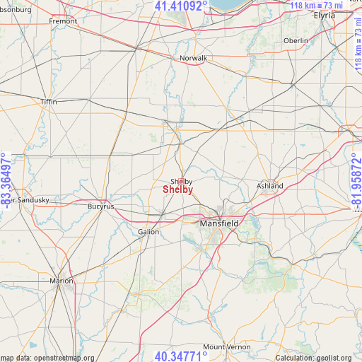
| Upper-left | 41.41092°, | -83.36497° |
| Center: | 40.88145°, | -82.66184° |
| Lower-right: | 40.34771°, | -81.95872° |
| Map W x H: | 118.2×118.2 km | = 73.4×73.4mi |
| max Lat: | 71.29058° ⇑35.6% North |
| Shelby: | 40.88145° |
| min Lat: | ⇓64.4% South 19.06759° |
| min Long | Shelby | max Long |
| -171.73463° | -82.66184° | -66.98998° |
| W 63.1%⇐ | ⇒36.9% E |
Elevation
Elevation of Shelby is 333 m = 1093 ft, and this is 38.2 m = 125 ft above average elevation for this country.
| Max E: |
3189 m = 10463 ft | 22.4% |
| Shelby | 333 m 1093 ft | |
| Avg. | 294.8 m = 967 ft | |
Min E: |
-60 m = -197 ft | 77.6% |
See also: United States elevation on elevation.city.
Geographical zone
Shelby is located in North temperate zone (between Tropic of Cancer and the Arctic Circle). Distance of this Northern Tropic circle is 1939.7 km =1205.3 mi to South.| Distance of | km | miles | from Shelby |
|---|---|---|---|
| North Pole | 5461.5 | 3393.6 | to North |
| Arctic Circle | 2855.6 | 1774.4 | to North |
| Tropic Cancer | 1939.7 | 1205.3 | to South |
| Equator | 4545.6 | 2824.5 | to South |


Nearby cities:
15 places around Shelby: (largest is in red/bold)
• Attica
27.8 km =17.3 mi,  317°
317°
• Bucyrus
27.6 km =17.1 mi,  252°
252°
• Crestline
12.2 km =7.6 mi,  211°
211°
• Galion
19.7 km =12.2 mi, 213°
• Greenwich
20.6 km =12.8 mi,  36°
36°
• Lexington
23.5 km =14.6 mi,  163°
163°
• Lincoln Heights
19.3 km =12 mi,  129°
129°
• Mansfield
18.4 km =11.4 mi,  138°
138°
• New Washington
18.5 km =11.5 mi,  299°
299°
• North Fairfield
25.1 km =15.6 mi,  9°
9°
• Ontario
14.8 km =9.2 mi, 156°
• Plymouth
12.7 km =7.9 mi,  357°
357°
• Shiloh
10.8 km =6.7 mi,  28°
28°
• Waynesburg
14 km =8.7 mi,  308°
308°
• Willard
19.8 km =12.3 mi,  344°
344°
Sources, notices
• [Note1] Compared only with cities in United States existing in our database
• [Src1] Map data: © OpenStreetMap contributors (CC-BY-SA)
• [Src2] Other city data from geonames.org with taken over terms of usage.
• [Src3] Geographical zone / Annual Mean Temperature by Robert A. Rohde @ Wikipedia
